Great Basin National park is home to the highest peak in Nevada, the oldest non-clonal trees on Earth, and some of the darkest night skies in the contiguous U.S.
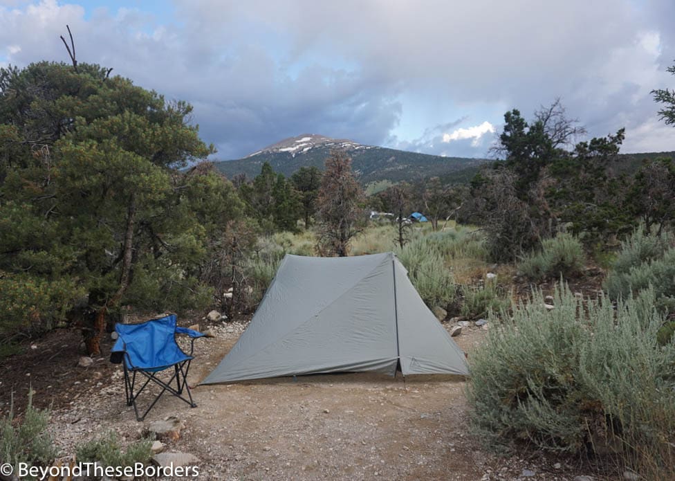
We spent 2 days / 3 nights in Great Basin National Park. We arrived in the late afternoon and drove up the Wheeler Peak Scenic Drive to our reserved campsite at Wheeler Peak Campground. A ranger told us that this campground is commonly thought of as the prettiest campground in all the national parks, and I can see why. Some campsites have gorgeous views of the mountains, which are especially incredible at dusk.
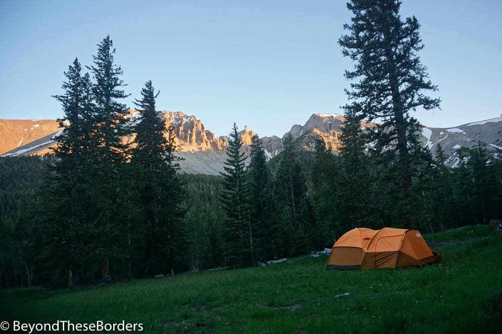
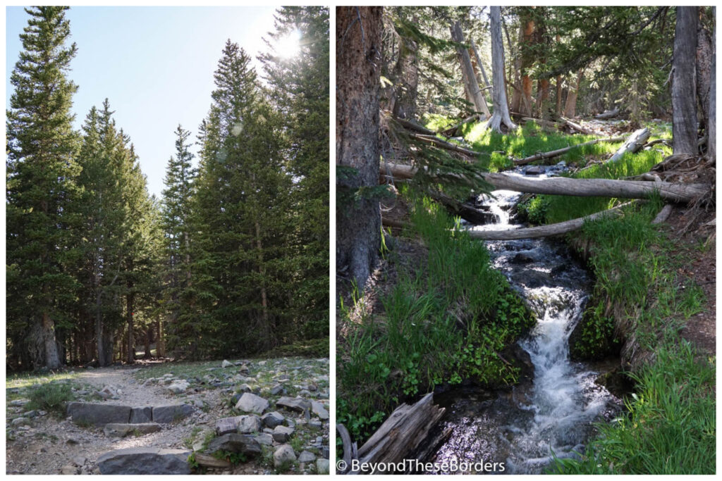
A small stream runs through the campground and we set up our tent within 20 feet of it. Falling asleep to the sound of a babbling creek was fabulous. The nearby water brought swarms of bugs. However, mostly they didn’t “bug” us. There was only a brief period at dusk and dawn that we had to protect ourselves from a few mosquitos. Also, the mid-July temperature was in the 90’s but the canopy of trees shading us from the intense sun provided great relief. The campground is located at an elevation of 9,500 feet, which means a cooler temperature than the lower portions of the park. If you are planning to hike up to Wheeler Peak, staying up here to help acclimate is a great idea.
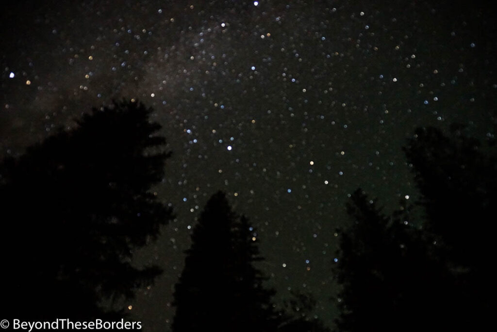
We had clear skies so we went to bed early and set our alarms for 2 am to check out the stars since Great Basin National Park boasts some of the darkest night skies in the contiguous states. It was dark, and a ton of stars were visible as well as a light haze from the Milky Way. We did feel a little disappointed however. We had seen such incredible pictures online. This may be a case of over-expectations due to some great time-lapse photography out there. These not professional (but long exposure) pics are more like what we actually saw.
Day 1: Lehman Caves and Alpine Lakes/Bristlecone Grove Hike
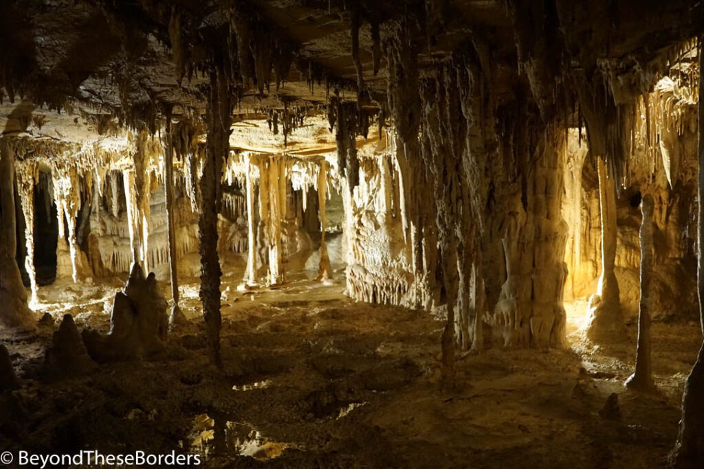
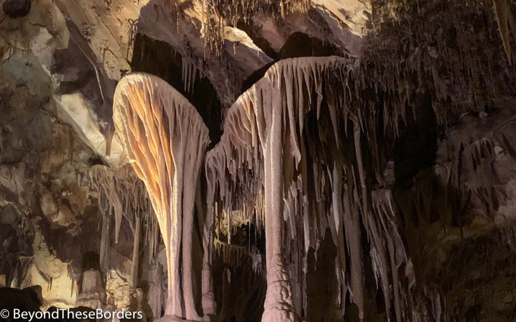
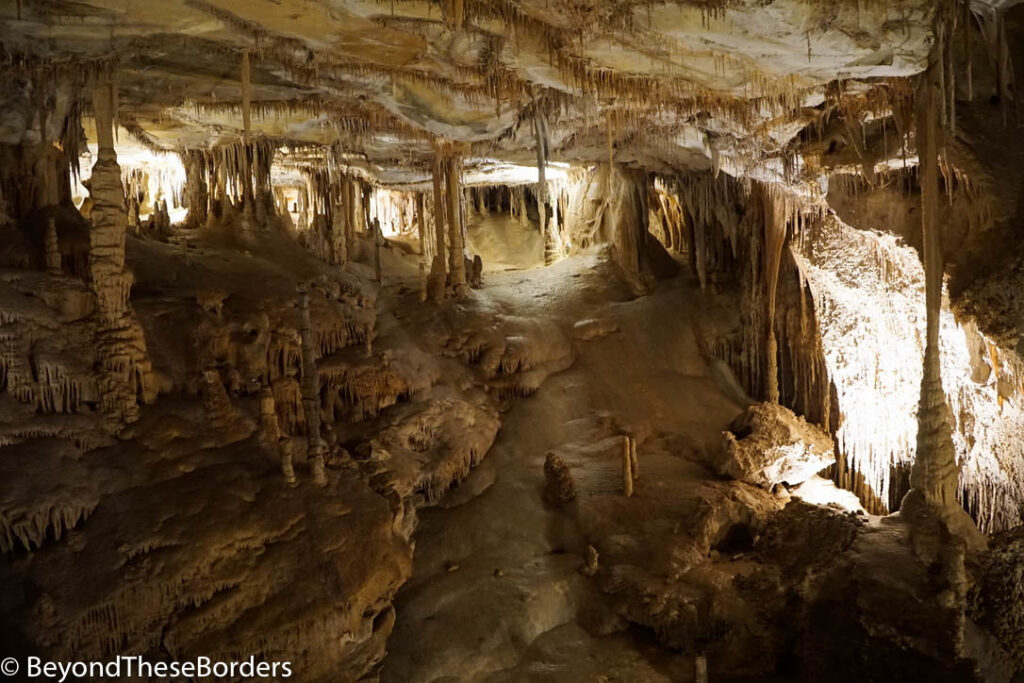
The Lehman Caves can only be entered with a ranger-led tour. Tours are available daily in either 60 or 90 minute formats, with the longer tour leading further into the tunnels. As you escape the immense summer heat into the cool reprieve of the cave, the glow of artificial light reveals beautiful gothic structures created naturally by the stalactites and stalagmites of the cave. As we wandered along the dark tunnels, we had to duck and shimmy to get between the low grade marble structures. It’s unreal to think that the marble that now is the base of these caves, started forming 5 million years ago.
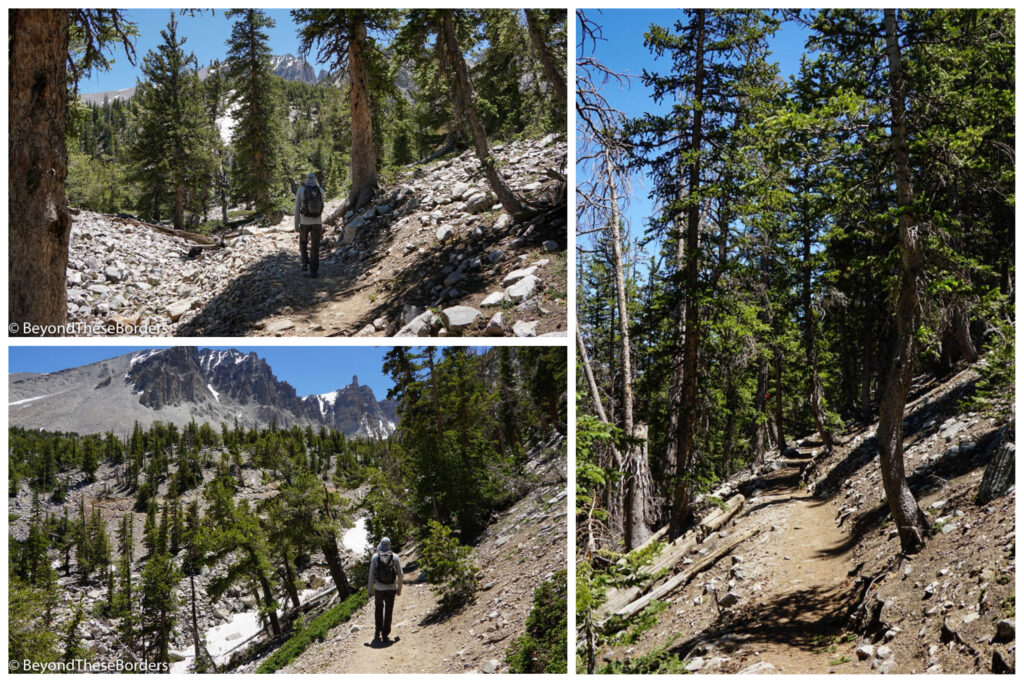
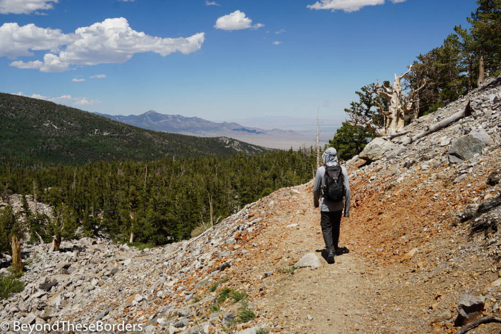
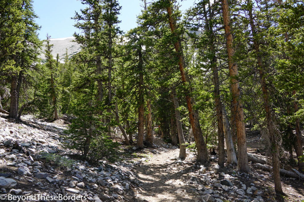
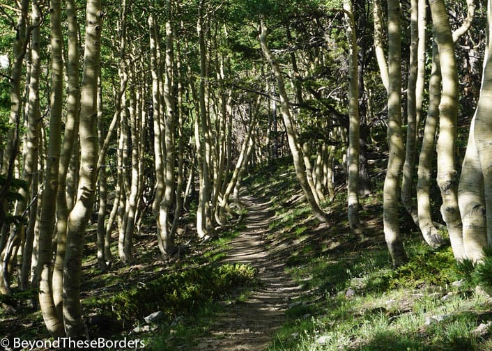
Next up, we grabbed our packs filled with water and snacks and started hiking. First we explored the Bristlecone Grove Hike (2.8 miles roundtrip) and then the Alpine Lakes Loop (2.7 miles roundtrip). It was pretty hot out, especially since we weren’t starting our hike until about noon, but thankfully there were quite a few trees providing shade for these hikes. The Bristlecone Grove trail followed a rocky tree lined ascent heading towards the mountains. For a small section, we had to go off trail to get around an area still covered in snow.
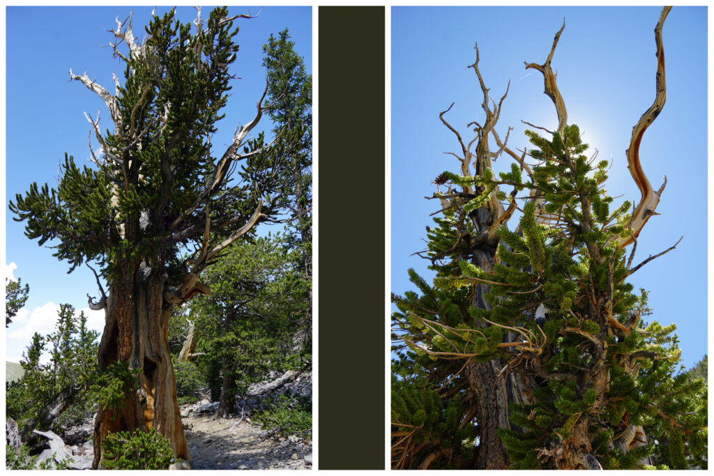
The bristlecone pines are the oldest non-clonal organism on Earth and are only found in Nevada, Utah, and California. One bristlecone pine tree in a grove in California is currently over 5,000 years old. Great Basin National Park contains trees that are over 4,000 years old. (Note: They aren’t the oldest trees as trees that can regenerate (clonal trees), connecting through a single root system with new trunks growing over time win this title.)
Bristlecone pine groves grow just below the tree line in harsh conditions. The high wind at this elevation twists the trees into eerie shapes. The pine needles resemble green pipe cleaners and can live up to 40 years. Some Bristlecone pines are a mix of both dead and alive branches; some are green while others are bare. Parts of the tree can continue to live with just a few surviving roots.
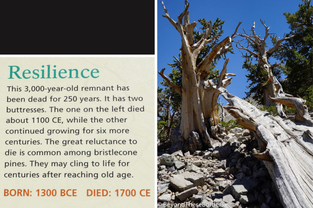
Bristlecone pines grow very slowly, adding an average of only 1 inch of girth per hundred years. They have hard and dense wood which can take thousands of years to decay after death. The most common reason for these trees to die is from erosion. The dry, rocky, steep ground erodes away, exposing the roots which then dry out and eventually the trees fall over.
Hiking back down from the Bristlecone Grove trail, we were able to turn left onto the Alpine Lakes Loop and were quickly at the first lake, Teresa Lake. This turquoise water has slim, green, pine trees surrounding it and a grey mountain as its backdrop. We took our shoes and socks off and refreshed our hot sweaty feet in the numbing water.
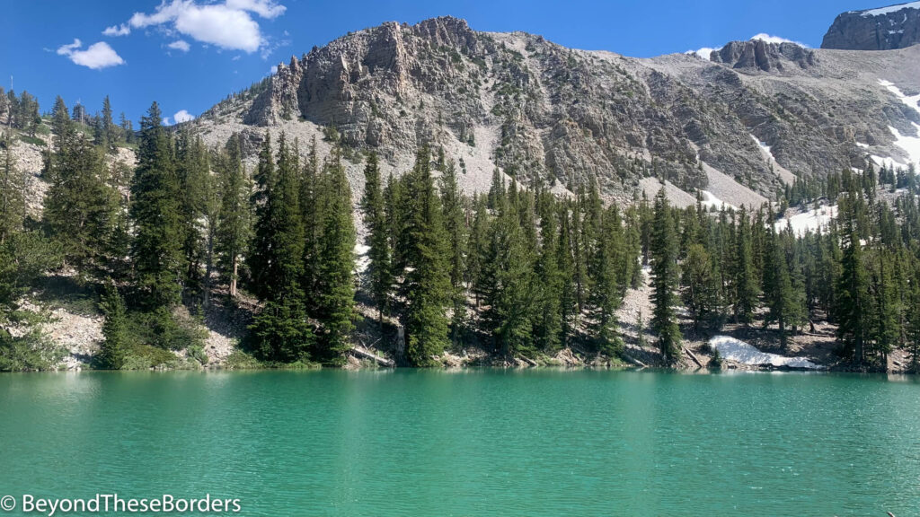
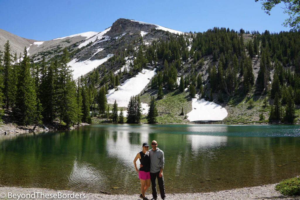
We left Teresa Lake and continued between scattered pine trees until reaching Stella Lake. Stella is a bit larger with a few less trees around its perimeter. The water was a bit darker then the previous lake and it had a great view of the snow covered mountains behind it. A few hikers were braving the cold water with a dip in the lake. From here it was an easy walk through trees and meadows back to our campground.
You can also add on the Glacier trail and visit Rock Glacier from the Bristlecone Grove. The Glacier hike was covered in snow still when we were there and cramp-ons were recommended. We didn’t do this part of the hike.
Day 2: Wheeler Peak Hike
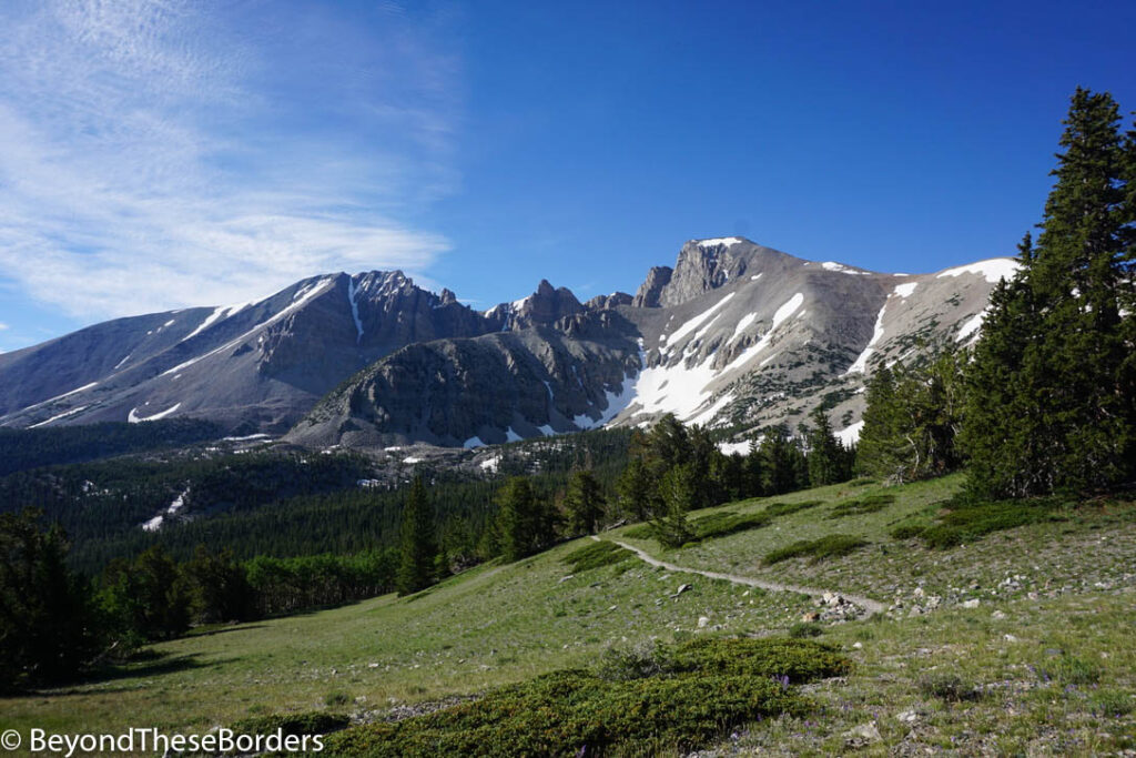
Wheeler Peak is Nevada’s highest mountain at 13,063 feet. A strenuous 8.6 mile roundtrip hike with 3,100 feet elevation gain brings you to the dramatic views at its peak. It’s recommended to start the hike early in the morning as it can take a good portion of your day and thunderstorms are more common in the afternoon.
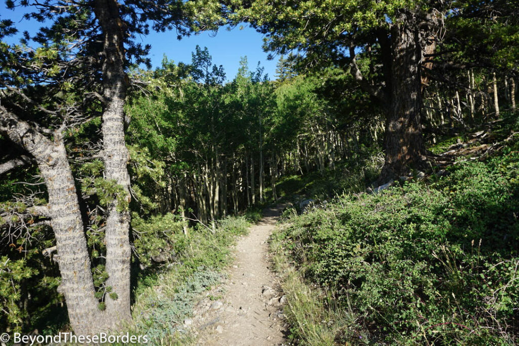
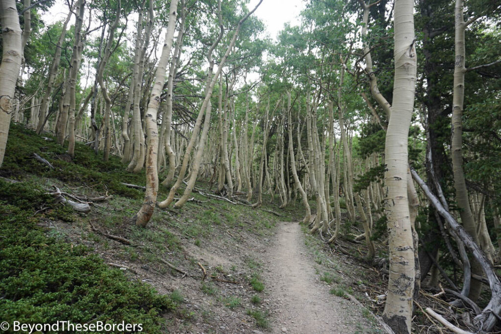
The first 1 1/2 miles is in the shade of a forest and we spotted three wild turkeys shortly after starting our hike. There were a few green meadows along the trail with fabulous views of Wheeler Peak and the surrounding mountains. A forest of pine trees hug the base of the mountains.
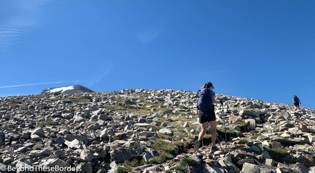
During the rest of the hike you are exposed to the sun and wind. Once you start climbing up the ridge to the saddle, it’s a slog upwards with wind whipping you as you stumble along the rocky trail. Nearing the top of this section, I was really looking forward to the ease of the relatively flat saddle. Unfortunately with the flatness came such an intense wind that I was using my poles to keep myself from being blown over. It was awful! We hid from the wind behind one of several makeshift walls constructed from the surrounding rocks and took a breather.
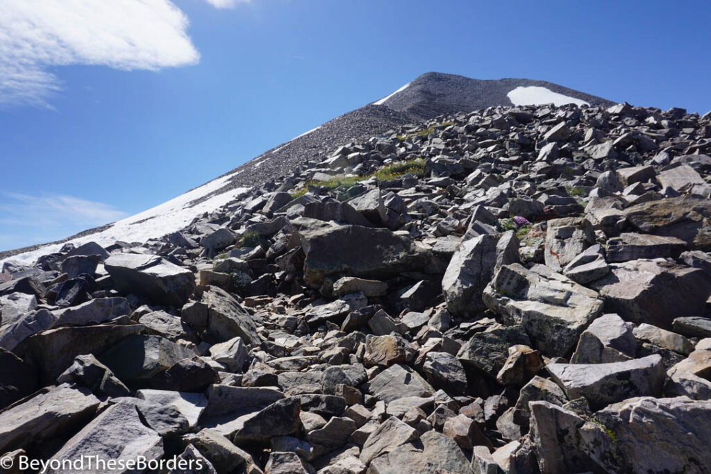
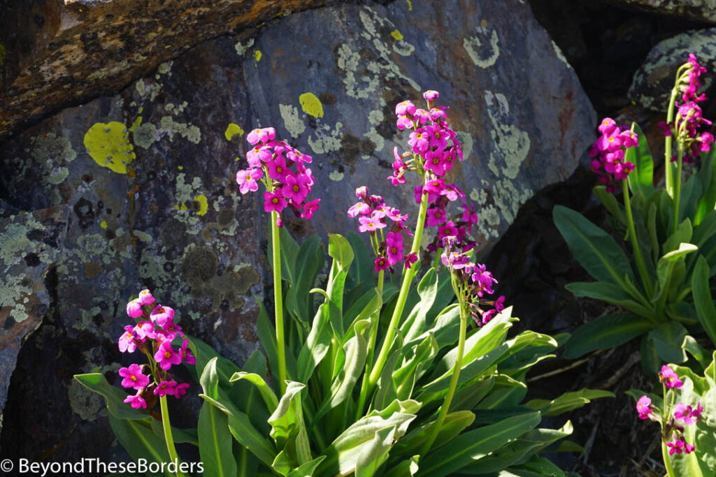
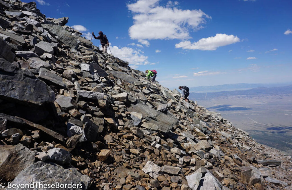
Then is was time for the real work, climbing up the summit. The climb was steep but the wind was less intense once leaving the saddle. Pretty wildflowers sprouted up between the large rocks on the ascent. Towards the top, snow was still covering part of the trail and we had to find an alternate route. We had to climb over rocks, testing them for sturdiness as we headed up. It was quite the adventure, but we had congregated with a few other hikers along the way and all worked together to conquer the climb.
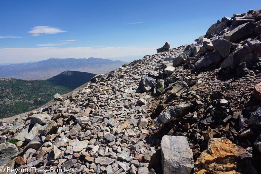
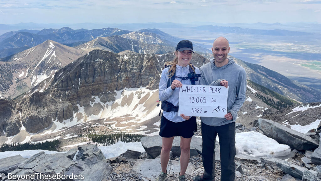
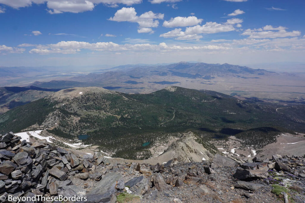
The top of Wheeler Peak rewarded us with stellar views over the Nevada desert, of mountains in the near and far distance, and a great sense of achievement. We took our photo with the Wheeler Peak sign (which you can find in the mailbox located in a wind shelter at the top) to share our achievement with friends and family.
Then it was time to make our way back down. It felt like forever to get back to the tree line, occasionally sliding in the loose rock of the trail. Some dark clouds rolled in and gave us a little sprinkle, but thankfully not enough to drench us. We were exhausted and ready to relax by the time we reached our car at the bottom.
Time to find a campground for the night.
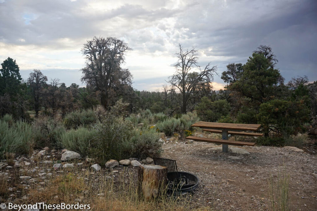
We drove through the first come/first serve campgrounds and found a nice spot to set up for the night in the Grey Cliffs Campground. Our location was very pretty, but missing the shade of any big trees. As it was late in the day, the temperature was manageable. However, if we had been planing to hang out during the sunny hours, we would have needed to hide under the shade of our tarp.
If you have more time and desire more hiking, there are backcountry hiking/camping options at the lower elevations of the park. We had hoped to hike and camp around Baker Lake but with the hot weather, chance of thunderstorms, and tired legs, we are saving this for if we get back to Great Basin National Park again one day.
Trip Planning Notes:
A few things to note if you are thinking about visiting Great Basin National Park. Even though this is not as well known as many other parks, it takes some luck and effort to reserve a campground and get tickets for the cave tour. This year the campgrounds were reservable 30 days prior. The morning they became available, all sites were gone instantly. As soon as the reservations opened we clicked a site and somehow it was already gone, and so were all the others. We failed to get a spot and had to check regularly for any cancellations. Only by luck did we manage to snag a spot in Wheeler Peak Campground for our 2 desired nights. The cave tours also regularly sell out quickly, so plan ahead.
Also, it’s a good idea to phone a ranger station to find out when they expect trails to open up. This year, due to extremely high snow fall, the trails opened later than usual. Bristlecone Grove trail only opened up the day we planned to hike it (July 16). Again we were really lucky. We had originally planned to visit in June but many trails would have been closed, so we changed our plans. We also heard that in August they often get much more rain, so mid July worked perfectly this year.
Great Basin National Park was a beautiful, interesting destination for a few days trip. I hope you enjoyed getting a glimpse from our experience.
I thoroughly enjoyed reading about the hiking experience! Photos were great!!
What an amazing trip and hike! Thanks for all the information and great tips on this National Park. I love the all the pictures of this beautiful park. I can’t wait to go there.
What an amazing hike! Those loose rocks look treacherous. I would love to see the caves you were in. Thank you for sharing all your beautiful photos.
Great pictures! Thanks for sharing all the info!