Kearsarge Lakes are 3 lakes nestled at the bottom of a valley in the Sierra Mountains of California. To reach these beautiful lakes requires a hike over Kearsarge Pass. While it’s possible to do this hike as a long day hike, I recommend taking a few days to really enjoy the scenery and cope with the altitude. We did this hike over 4 days including the 6+ hour drive each way from Southern California.
Day 1: Hike from Onion Valley Campground to Gilbert Lake
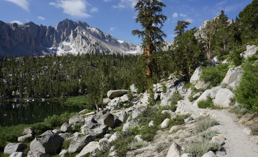
Leaving San Diego around 6 am, we arrived at Onion Valley Campground around 12:30 pm. We left our car in the parking lot (free of charge), gathered up our packs, and began our hike on the Kearsarge Pass Trail.
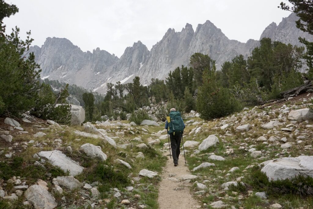
Gilbert Lake was just a 2.4 mile hike from our parking spot and about 1,200 feet of elevation gain. While this isn’t a long hike, the elevation does make it harder. We had driven up from sea level that morning and the hike starts at around 10,000 feet high.
Less than 10 minutes into our hike, it began to rain. We stopped and put on our raincoats within minutes the rain ceased. Feeling overheated, we stopped again to take them back off. We stuck with the no raincoats decision as the rain very lightly came down a bit further into the hike.
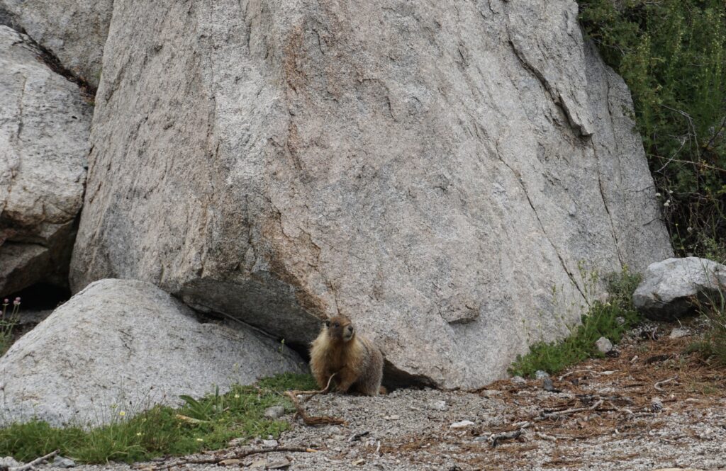
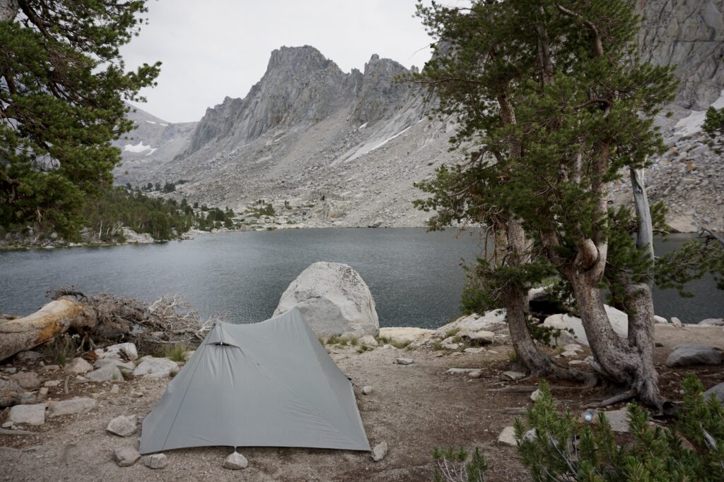
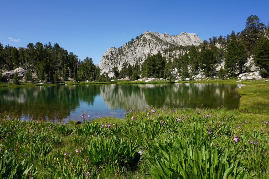
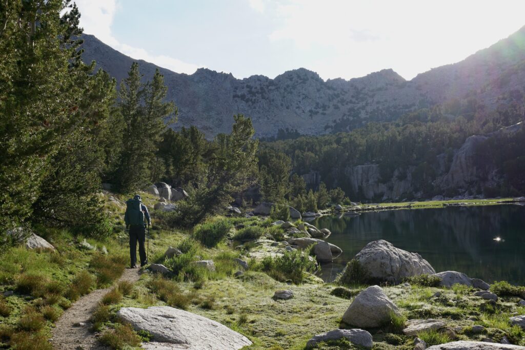
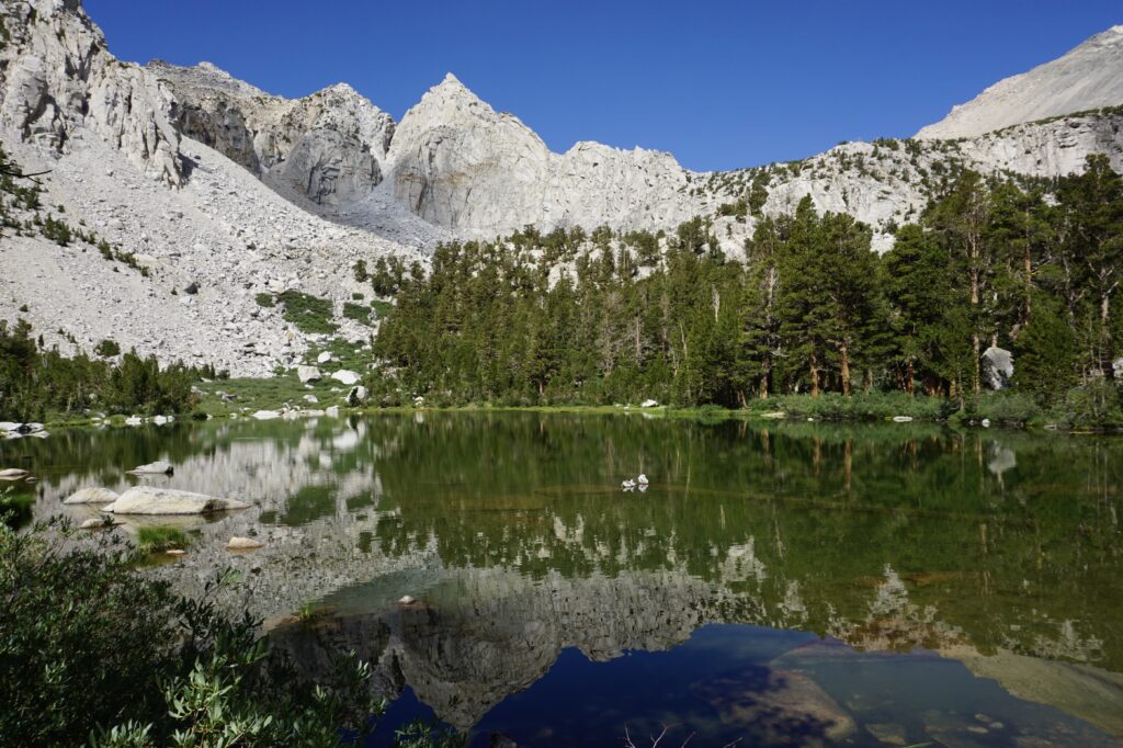
It was still gently raining as we arrived at Gilbert Lake, so we set up our tent right away and then sheltered within. Shortly thereafter, the rain stopped and we heard chirping. We thought a squirrel was right next to our tent, but when we crawled out to investigate, we discovered that it was a very large marmot about 25 feet away. Soon we noticed there were more marmots. They were on top of the giant rocks, scampering out from under the rocks, and even more on the other side of our campsite. We decided that Gilbert Lake should be nicknamed “Marmotville”.
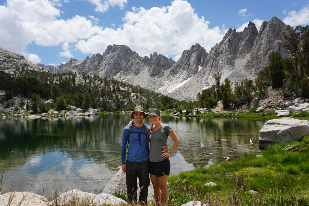
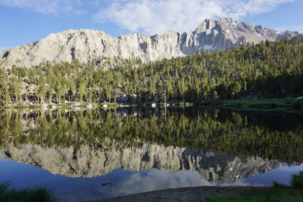
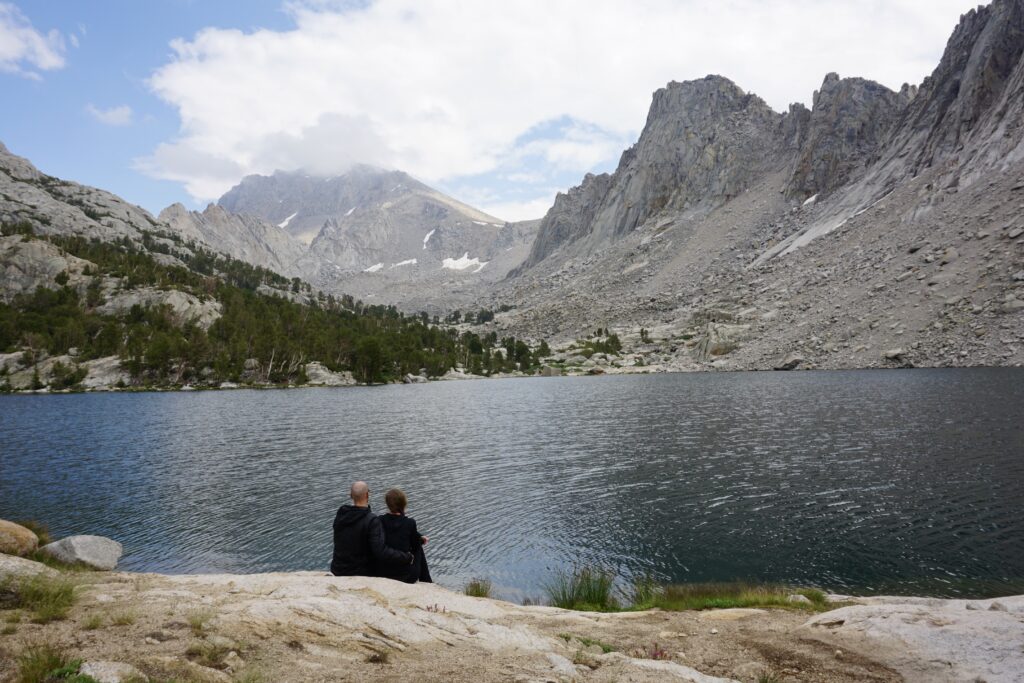
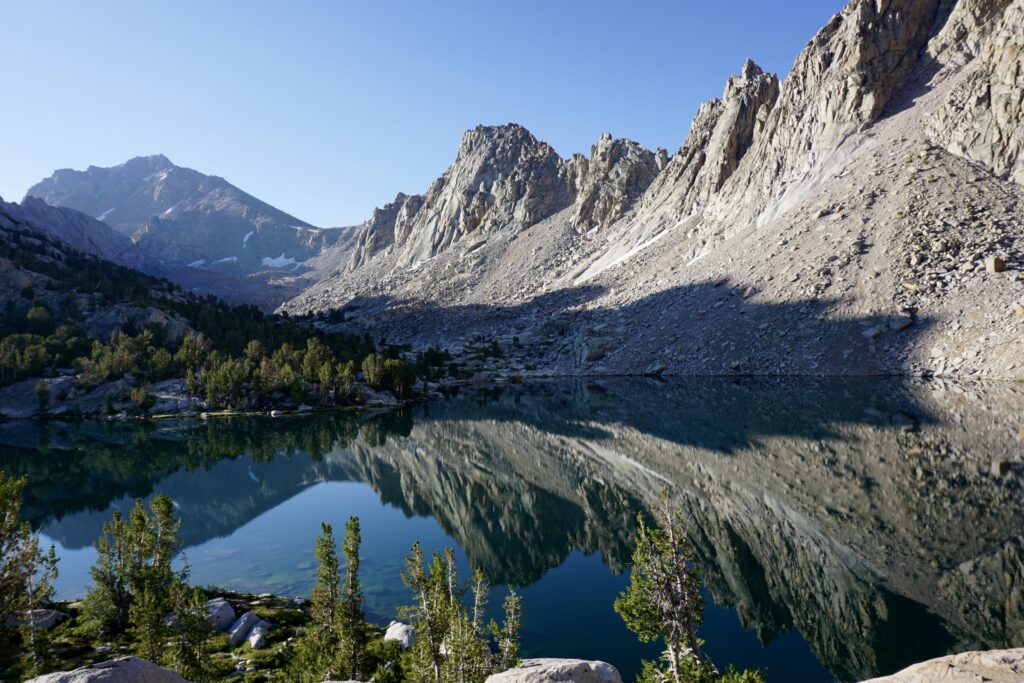
Now that the rain had stopped and we had solved the mystery of the chirping, we were able to enjoy the view. Gilbert Lake is a fairly large lake with gorgeous grey mountains behind it. In the late evening, a mirror image of the mountains reflected up from the calm lake water. It was a very quiet area and we were the only ones camping there that night.
We make our dinner and crashed early, exhausted from the long day of driving and short hike at elevation. Thankfully, no marmots joined us in the tent that night.
Day 2: Hike from Gilbert Lake to Kearsarge Lakes
After a long and rejuvenating sleep, we woke up early to enjoy the lovely surroundings with breakfast and coffee. We didn’t have far to hike this day, so we really took our time relaxing in the morning before packing up and hitting the trail again.
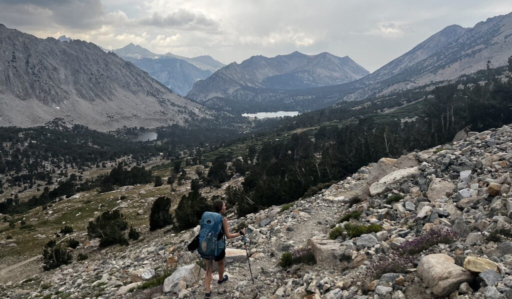
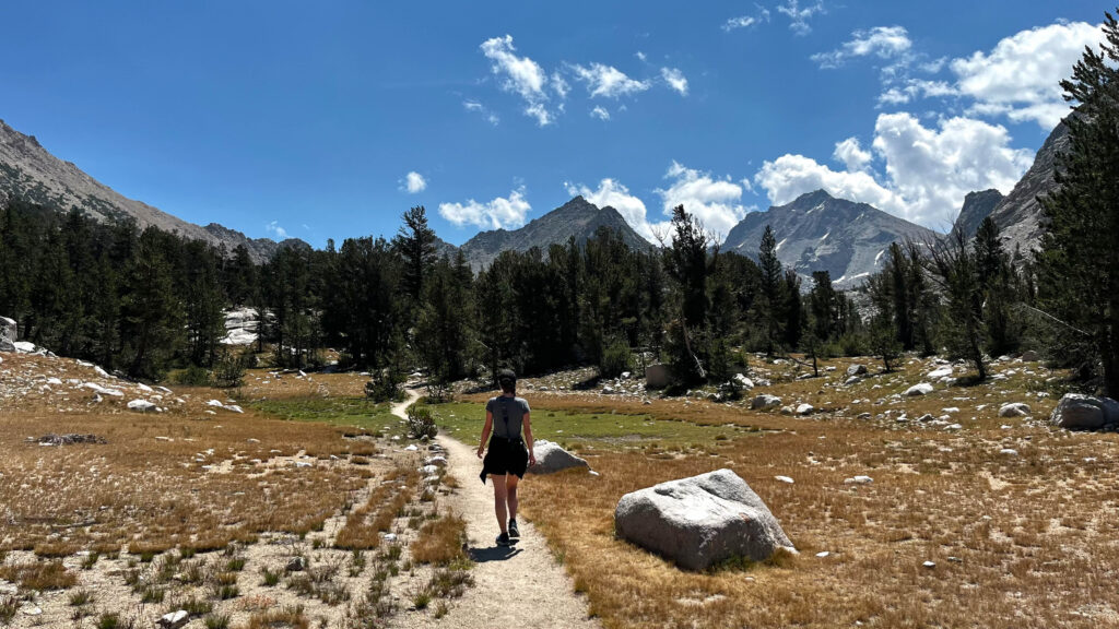
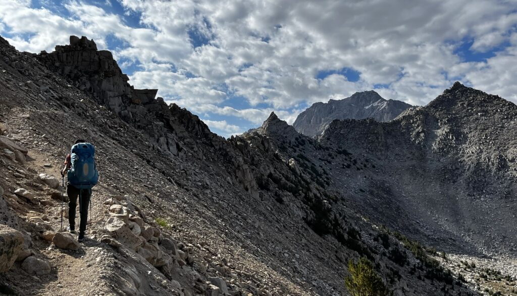
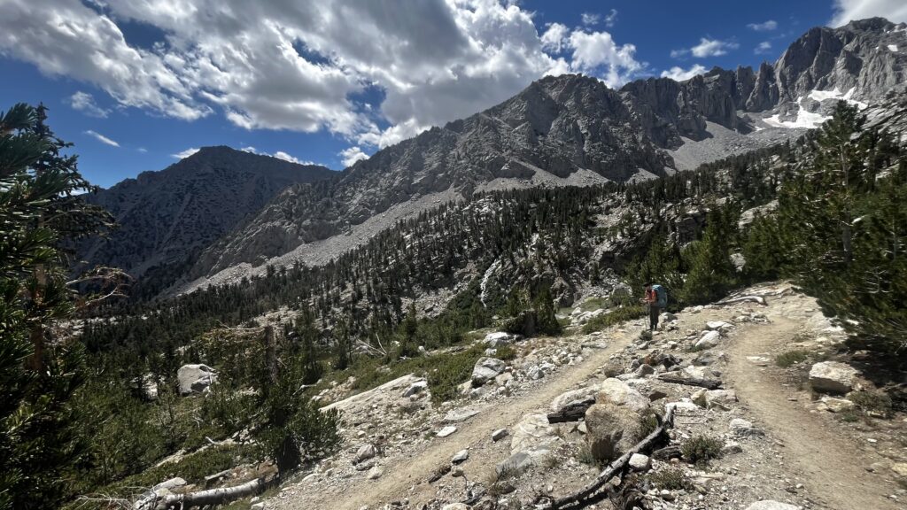
Once back on foot, we had a 1,500 foot climb and a little over 2 miles hike up to the top of Kearsarge Pass. The pass towers at 11,760 feet. Once we reached the summit, we would then hike down about 900 feet to the valley where we would find Kearsarge Lakes.
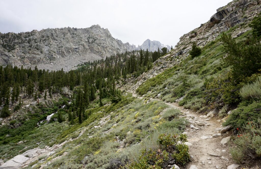
We hiked slowly to cope with the altitude that we hadn’t had time to fully acclimate to yet. Along the way, some really stunning views helped pass the time. There are two lakes which are highlights. The first is Heart Lake, named after its heart shape.
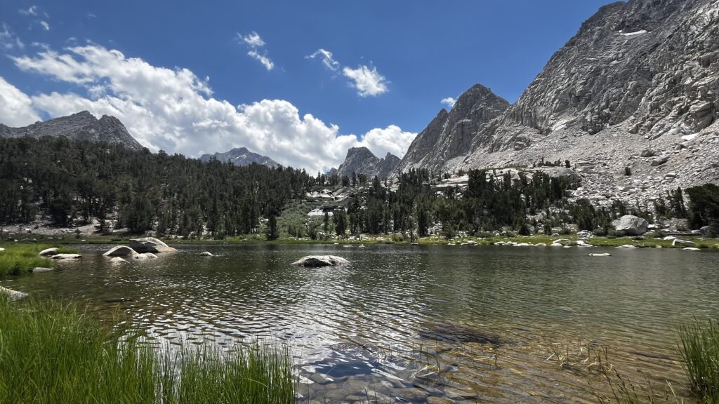
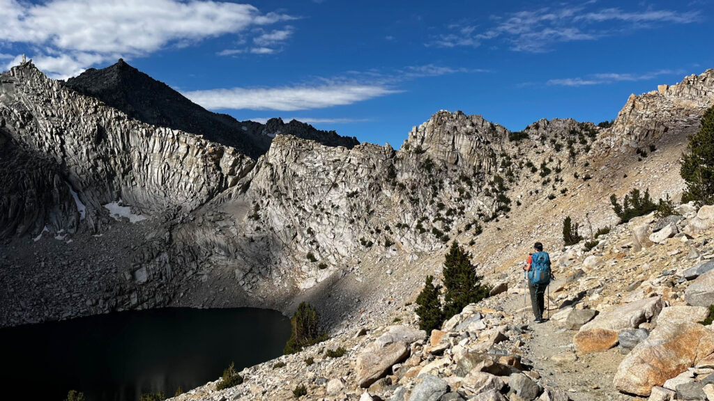
Big Pothole Lake is the biggest highlight on the way up, in my opinion. This large lake lies far below as you hike up a number of switchbacks, luckily visible for much of the final stretch of the hike up. The rocky mountain above Big Pothole Lake is very dramatic.
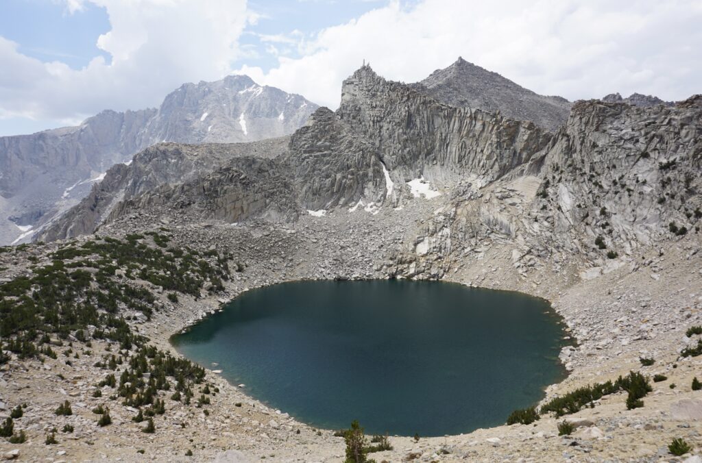
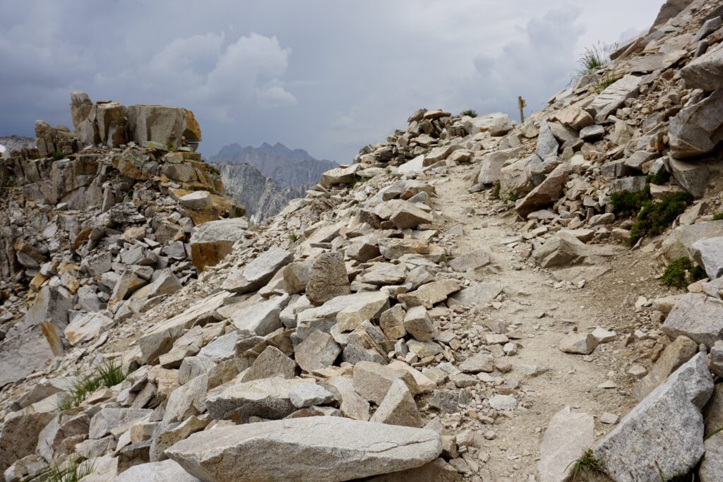
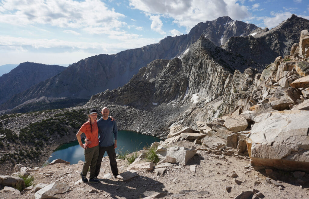
You can still see Big Pothole Lake as you hike the final rocky stretch to the top of the pass. Once on top, the view over the green valley filled with lakes and surrounded by mountains is stunning. We got some photos and took a short but and well deserved rest on top. The sky had begun to darken with clouds and some thunder began to rumble beyond the mountains. We decided we should get going before it had a chance to become too stormy and drench us on the way down.
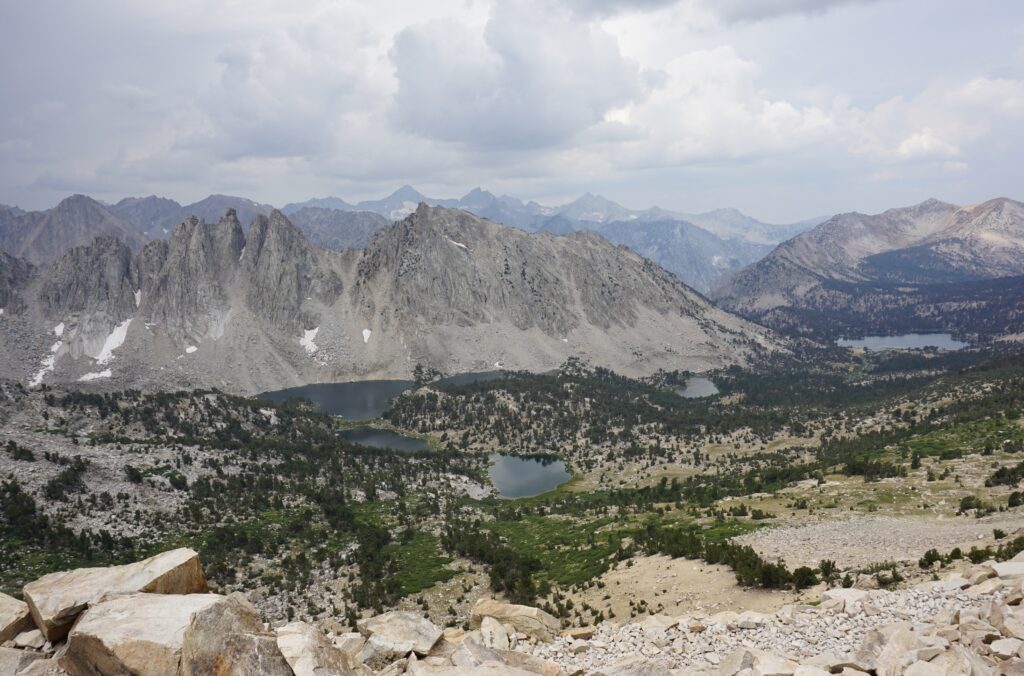
We only had to hike about a mile and 900 feet down to reach the valley and short ways further to the first lake. The steep hike didn’t take long and the lakes were in view for most of it.
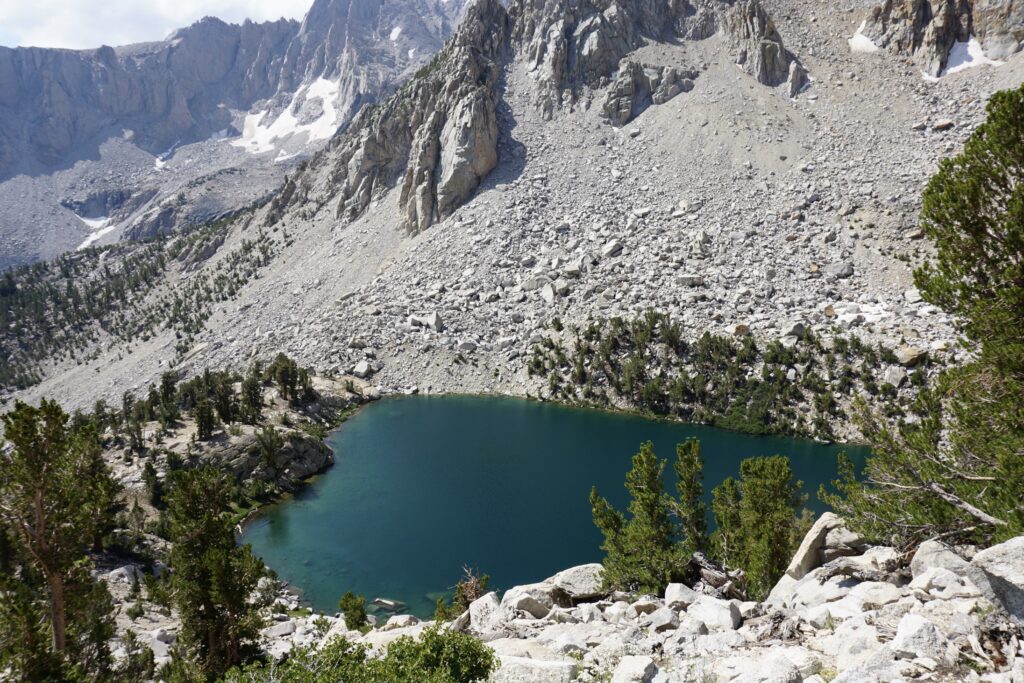
It had begun to rain gently, so we didn’t stop to enjoy the views at Kearsarge Lakes as we approached the first of the lakes. We were on a mission to find a spot to set up camp before getting too wet. We hiked along the water edge and saw some nice campsites but they were all taken. Along the lake trail we spotted some bear scat (yes there is reportedly lots of bear activity in this area). As cool as seeing bears would be, I silently hoped we wouldn’t actually find any. As we hit what looked like the end of the trail half way along lake three, we found a spot up on the rocks with a nice view of the lake. Yay!
Once we set up camp, the rain ceased once again and we were able to explore and enjoy our surrounding area of Lake 3. We had easy access to water for filtering and some trees for shade. It was a great find for a campsite. Dinner and some relaxing with the lake view wrapped up day 2.
Day 3: Explore Kearsarge Lakes and Bullfrog Lake
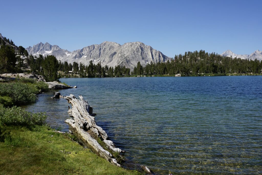
This was our easy day, or at least kind of. We were leaving our campsite set up and going to return to sleep a second night along Kearsarge Lake 3. We enjoyed the early morning at camp, then packed up a few necessities for a day hike. We followed a trail around the rest of Kearsarge Lake 3 and to the tiny unnamed lake beyond it.
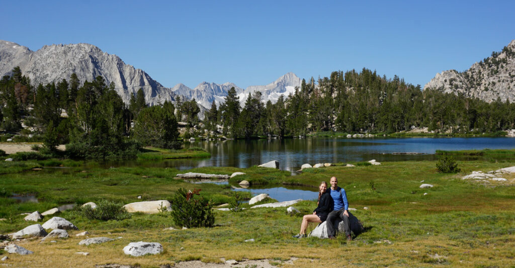
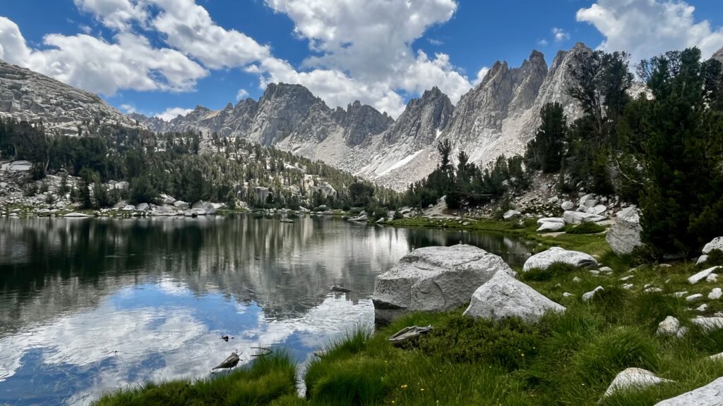
We had wanted to continue to the next unnamed lake west, but were unable to find a possible route. Giving up, we rerouted back to the main trail that would lead us to Bullfrog Lake. We loved Bullfrog Lake and we had it all to ourselves. Layers of mountains rest behind the large, tranquil lake. We relaxed here a while and wandered around the lake before heading on.
Next, we decided to follow the trail around and past Bullfrog Lake to a small lake just a bit further west. This tiny lake was surrounded by purple wildflowers busy with pollenating bees.
Before leaving the small lake, we filtered some water and started the hydrating process for our cold soak lunch. It would take 90 minutes to be ready, so we stashed it into our day bag and hiked back past Bullfrog Lake and decided to try to find the one lake in the area we had missed. This lake doesn’t have a trail to it, so we had to bushwhack our way to its shore. After enjoying the view for a bit, we hiked back to the trail and on towards Kearsarge Lakes.
This time when we came upon Kearsarge Lake 1, we stopped to enjoy the view. Wow! It really is an amazing view looking over the lake towards the mountains behind it. After getting our pics, we continued on towards our campsite. Once back to camp we enjoyed our hydrated lunch. Later that afternoon, we took a swim in the lake which was chilly but not nearly as cold as expected. The rest of the day was very relaxed. Our total mileage and elevation for our day hiking around the valley was 4.8 miles and 700 feet elevation.
Day 4: Hike from Kearsarge Lakes to Onion Valley Campground
This was the final day of our hiking trip. We left camp early in the morning to begin the climb back up and over Kearsarge Pass. The steady climb up didn’t feel as tough as we had anticipated. Once at the top, we reveled in the view of Big Pothole Lake right below us.
The hike down was much easier than the hike up, and we did it with many less breaks. Our total mileage from our camp site on Kearsarge Lake 3 back to our car at Onion Valley Campground was around 6.5 miles.
Most of the hike down was exactly what we had seen on our way up with the exception of Flower Lake. To reach this lake you need to take a super short side trail, over a little wood bridge not too far from Gilbert Lake. The area surrounding the lake has camping available and could be another overnight acclimation option in route to the pass. After checking out Flower Lake, we continued down the rest of the trail to our car at Onion Valley Campground Parking Lot and then started our drive home.
Planning Information:
Where is it?
The Kearsarge Pass Trail is in the eastern Sierra Nevada Mountains in California. Parking for the trail is at the Onion Valley Campground. It’s about 13 miles west of the town of Independence, CA.
Getting a Permit:
Wilderness permits are required for overnight trips but not day hikes. You will want to get the Kearsarge Pass Trail permit. Since this trail is so popular, it can be challenging to get permits. A limited number are released for each day. 60% of the spots are released 6 months before the entry date and the other 40% are released 2 weeks before. Permits are released at 7am PT. In my experience, during the summer they are all gone within a couple of minutes after posting. Log on and attempt to put one in your cart as soon as the clock strikes 7.
They can be purchased on the Inyo National Forest – Wilderness Permits site. Here’s the link: www.recreation.gov/permits/233262
Directions to obtain a permit:
- Click “Explore Available Permits”
- Answer yes or no to if it is a commercial guided trip.
- Switch “permit type” to “overnight”.
- Pick your desired date.
- Enter the number of people in your group.
- Click the number under your date for Kearsarge Pass out of the list of trailheads. (If it has a “W” listed, then the permits haven’t been released yet. Refresh your page and try again)
- Click “Book Now”
- Enter the empty fields including your exit point and exit date. Read the information listed. You have 15 minutes to complete your reservation.
- Remember to print your permit and bring it with you on the hike.
Final Thoughts:
Hiking over Kearsarge Pass and camping a couple nights at Kearsarge Lakes was a wonderful trip. The hike up to the pass is challenging with a rewarding view. The scenery along the way keeps it interesting with some impressive lakes. Once down in the valley, Kearsarge Lakes offer a great camping area to spend a couple days. There are multiple lakes to explore on day hikes. This is another incredible experience offered by the Sierra Mountains of California.
If you are looking for another hike in the area, I also loved the Big Pine Lakes Hike. While the hike is a bit less challenging, the lakes are even more stunning on this trail. Check out my Hiking and Camping in Big Pine Lakes blog post to learn more.
Sounds like a fantastic time!
Did you encounter any bears or scat?
No, we didn’t encounter any bears but we did see come scat not too far from where we camped.
I still remember this beautiful hike from about 1969! It was so dry on the east side out of Onion Valley, then to reach the top of the peak and look down on the lush, lake-filled valley was exhilarating! Unforgettable. Thanks for your gorgeous photos.
Memories! I made the hike up Kearsarge in ’65 as part of a Naturalism class at UCSB. We did it at night under a full moon. The light was sepulchral on boulders and the lakes black like holes through the Earth so the reflected stars seemed we were looking through to the far side. We “slept” on the boulders at the top. This was in October so cold. From there we jogged the Muir Trail to King’s Canyon.
Wow, that sounds like an incredible experience! Great memories!!