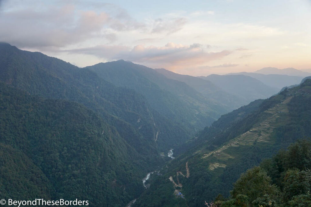
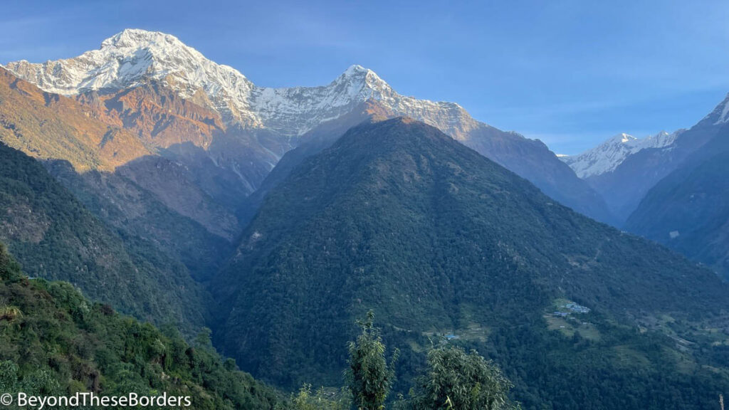
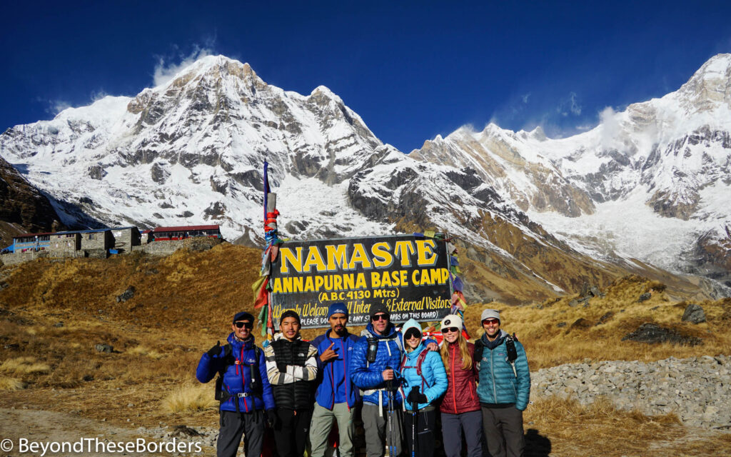
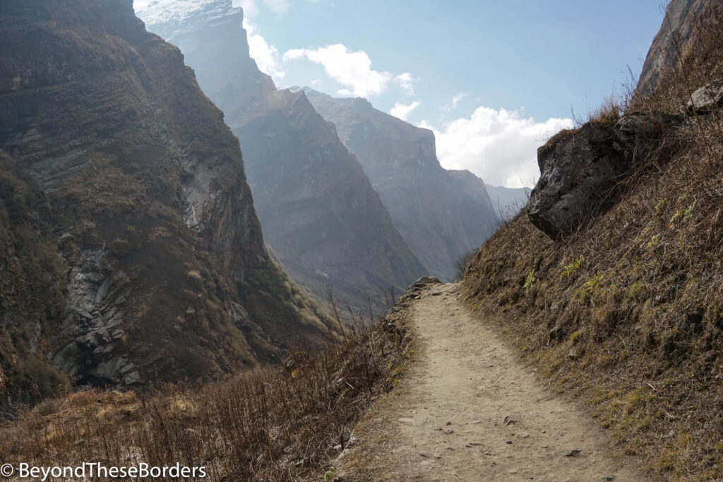
As we started the final section of our hike to Annapurna Base Camp, a thick eerie fog rolled in. For most of this last stretch, we couldn’t see more than 50 feet in front of us, much less the giant white peaks we were hiking towards. As we walked up the final hill, the clouds began to lift and open up a bit. We could spot the lodges and portions of the towering mountains behind. We had finally made it to Annapurna Base Camp!
We hiked a total of 8 days up to and back from Annapurna Base Camp in Nepal in November 2022. It was a beautiful journey. Lots of hills, stairs, little villages, and gorgeous views filled our days. Following is a description of our journey and a bunch of photos to depict the adventure. All hiking distances listed for each day are an estimate based on our personal hiking apps used during the trip.
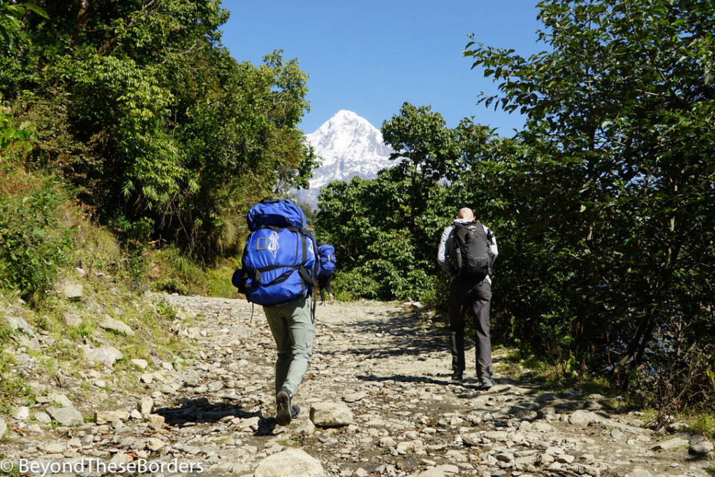
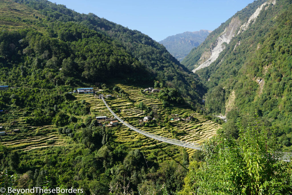
Day 1: Driving from Pokhara to Kimche, then hiking Kimche to Ghandruk (1.6 miles)
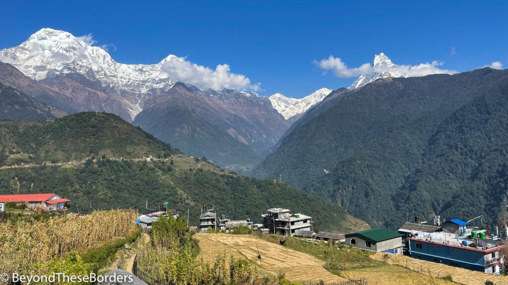
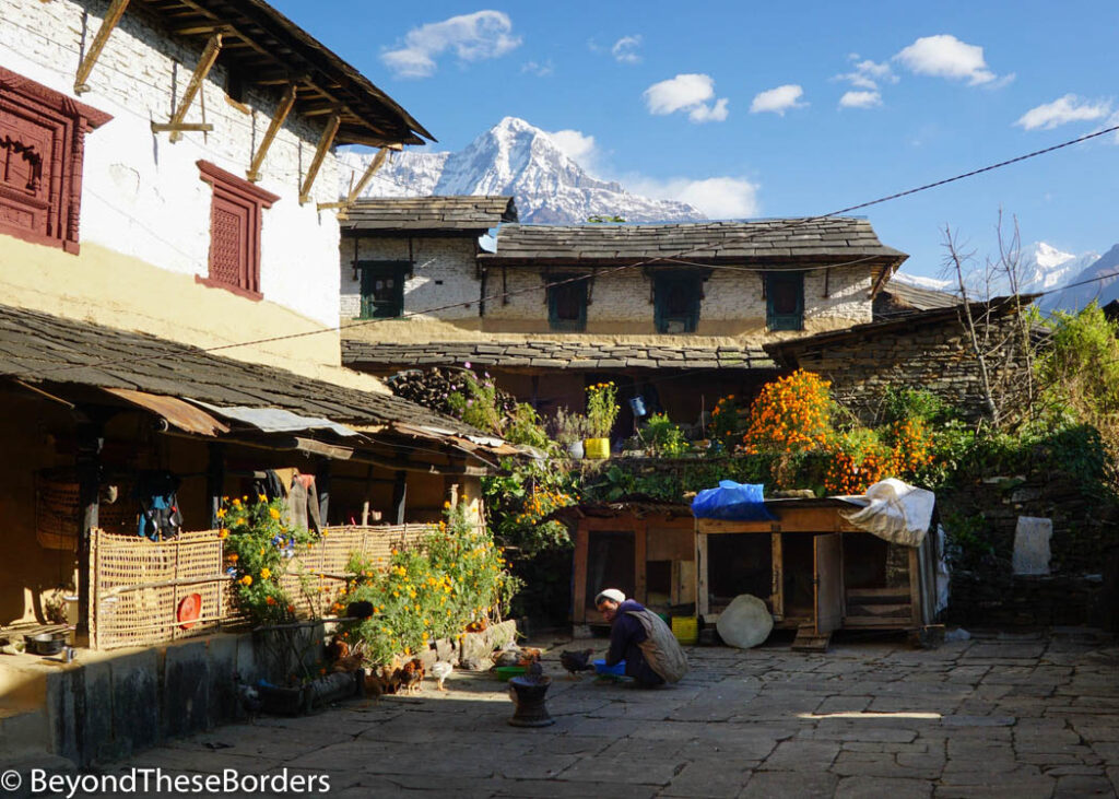
Our guide and porters picked us up in Pokhara and our journey began. We drove about 3 hours to the tiny village of Kimche. Here we stretched out our legs, strapped on our packs, and took the first steps of the trek. We caught a glimpse here and there of mountain peaks, but this was the least scenic hiking day. As we reached our lodge in the village of Ghandruk, our eyes were treated to the stunning view of Annapurna South, Hiunchuli, and Machhapuchhare (commonly referred to as Fishtail) rising up behind smaller green and brown mountains. Hello to the Himalayas!
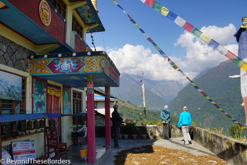
After unloading our packs and refueling our bodies, we walked around the village to get a taste of the local culture. We visited the Gurung Museum. The Gurung people are an ethnic group indigenous to the hills of the Annapurna region. This museum is set up in a traditional Gurung home and displays a wide range of household items that were traditionally used. The electricity happened to be out when we stopped by, so we had to explore the building via the flashlights on our iphones.
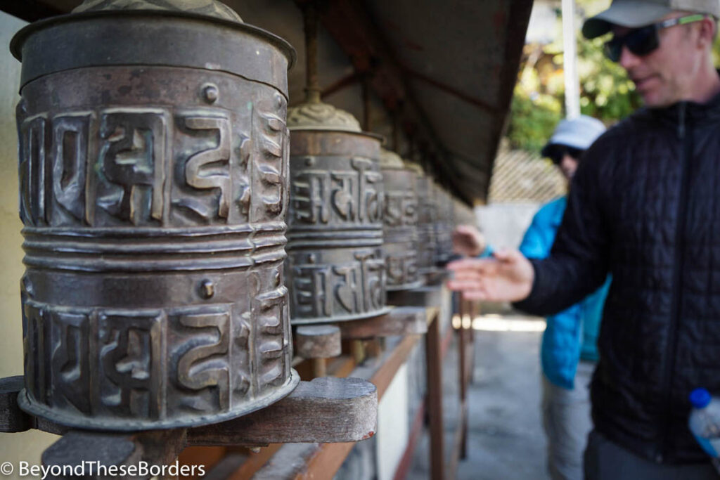
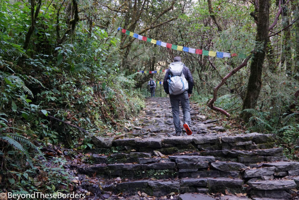
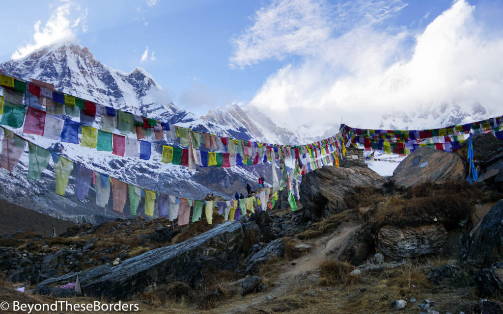
We walked around the outside of a local temple, spinning prayer wheels surrounding the whole building. Colorful prayer flags draped out from the roof and a local crop like millet was laid out, drying on the open air concrete flooring in front of the building.
Cobs of corn hung, drying in the sun, around the porch and windows of a building next door. Stone steps led us past stone buildings, laundry hanging on lines out front, and chickens scouring the ground for food.
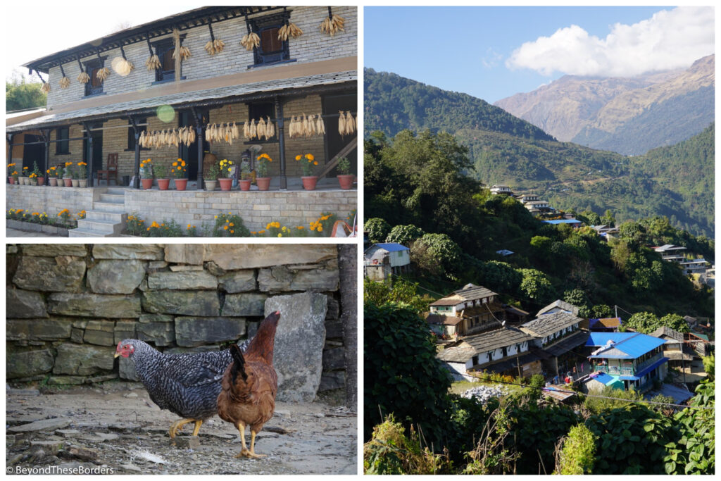
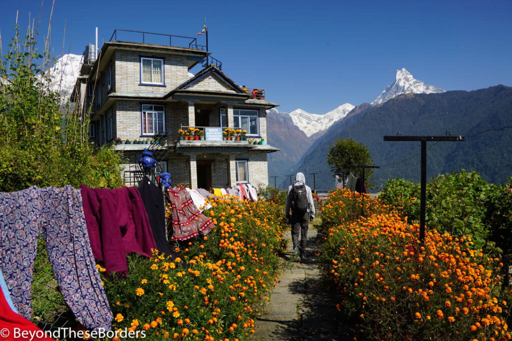
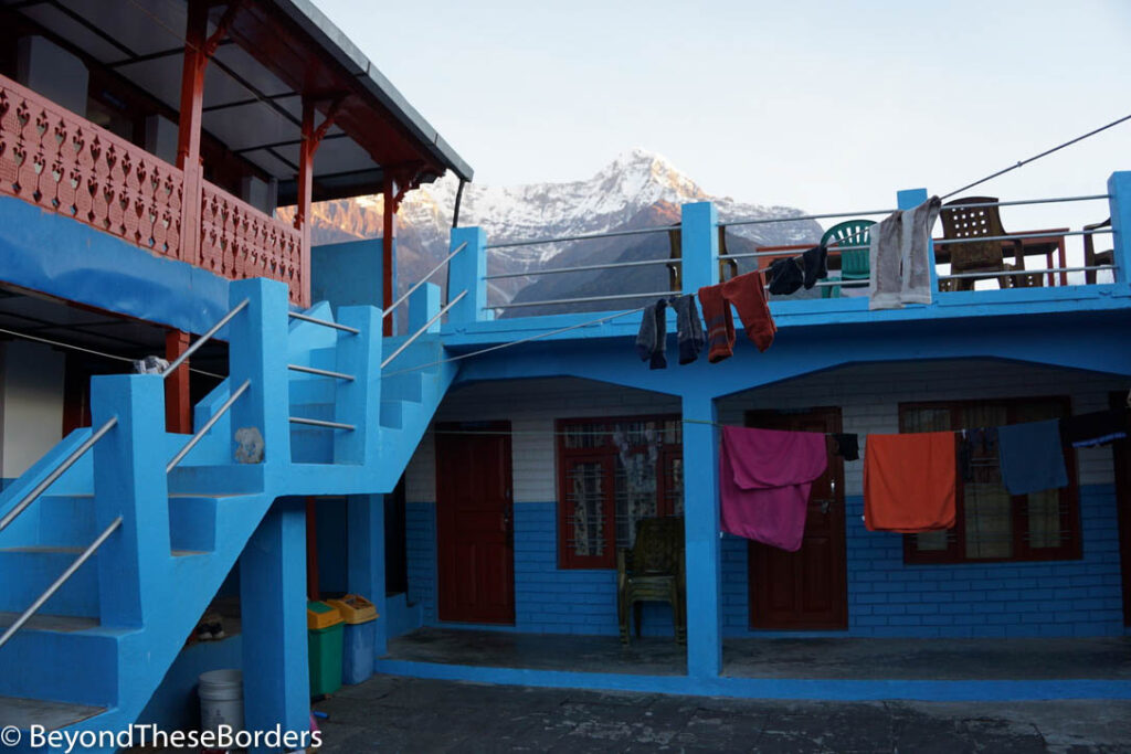
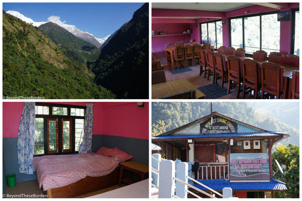
Back in our lodge, we savored the view of the mountains behind the village as the sky darkened. The lodges were fairly similar throughout the hike. The closer we got to Annapurna base camp however, the less “luxuries” that were provided (like hot water for a shower). None of the lodges were heated and the nights got colder the further up we hiked. Our tour company provided warm sleeping bags for our hike, and the lodges had super thick blankets to layer on top of our sleeping bags. Each lodge had a dining area, and they all shared the same official menu which actually provided good diversity of food options. They had the Nepali dish called dhal bat (kind of like curried veggies, lentil soup, and rice though it’s a bit different at every restaurant), momos, spring rolls, pizza, sandwiches, omelets, bread and jam, pancakes, and oatmeal just to name a few.
Day 2: Ghandruk to Chomrong (5.5 miles)
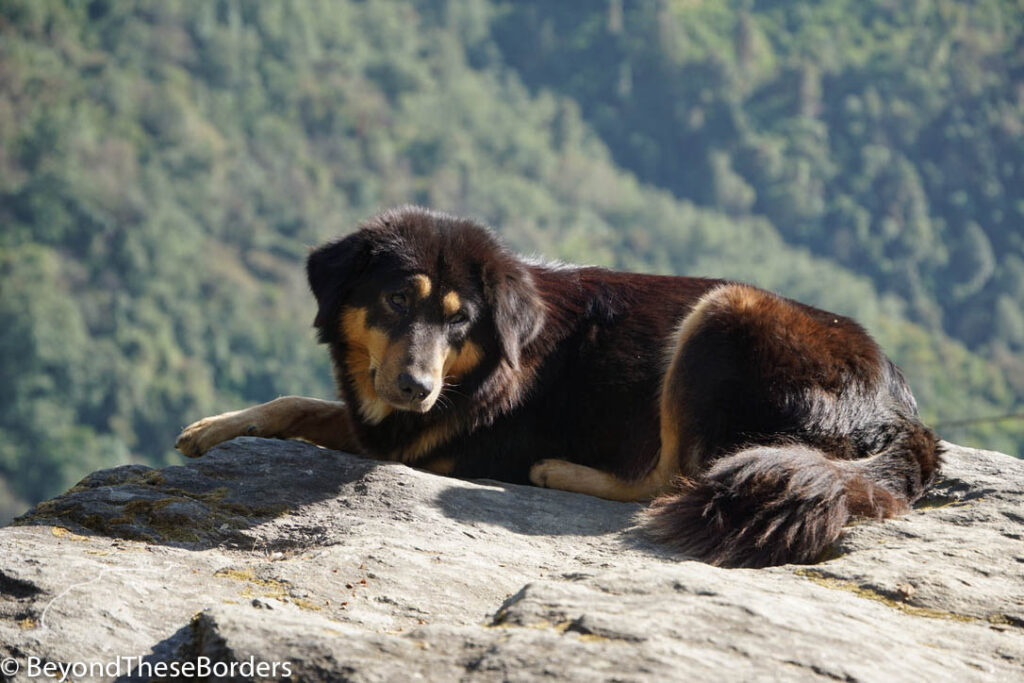
We crawled out of bed early to take in the dawn view with a steaming cup of coffee warming our hands. After breakfast we hiked out of the village and down towards a small river, a sable colored dog following us the whole way.
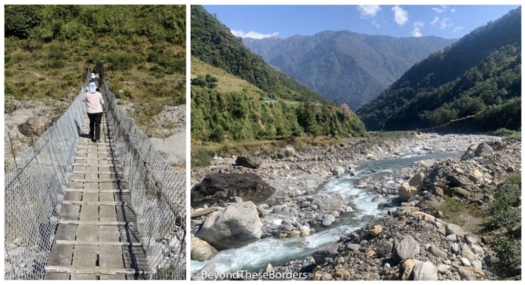
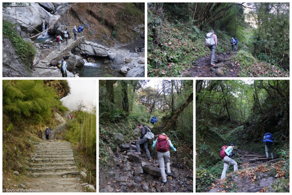
There are many bridges on this hike, but this specific one over the Kimron river made me the most nervous. It was made of wood planks that seemed rather old. Views of the shallow river from the spaces between planks led my brain to continuously play visions of the wood snapping and a sudden fall.
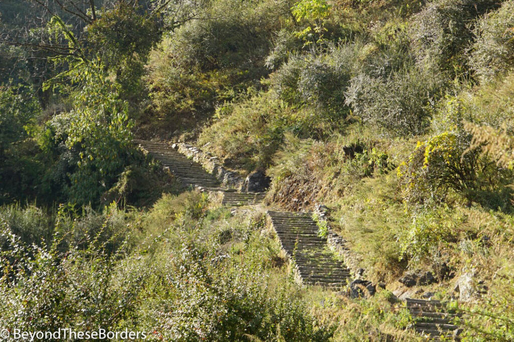
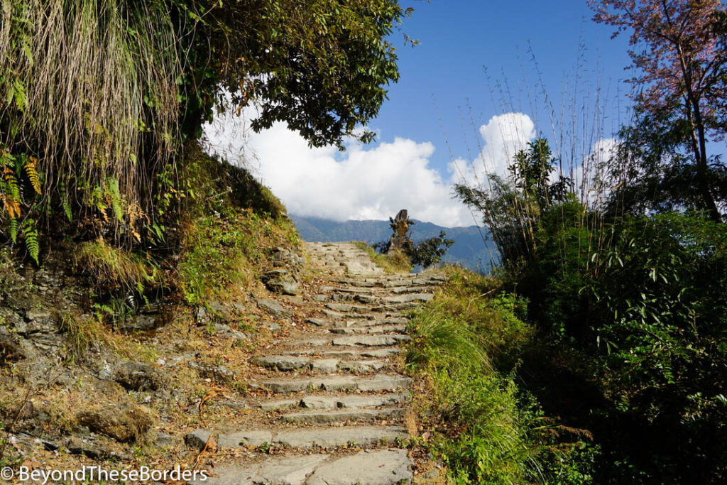
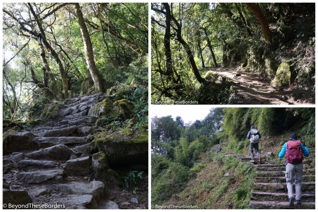
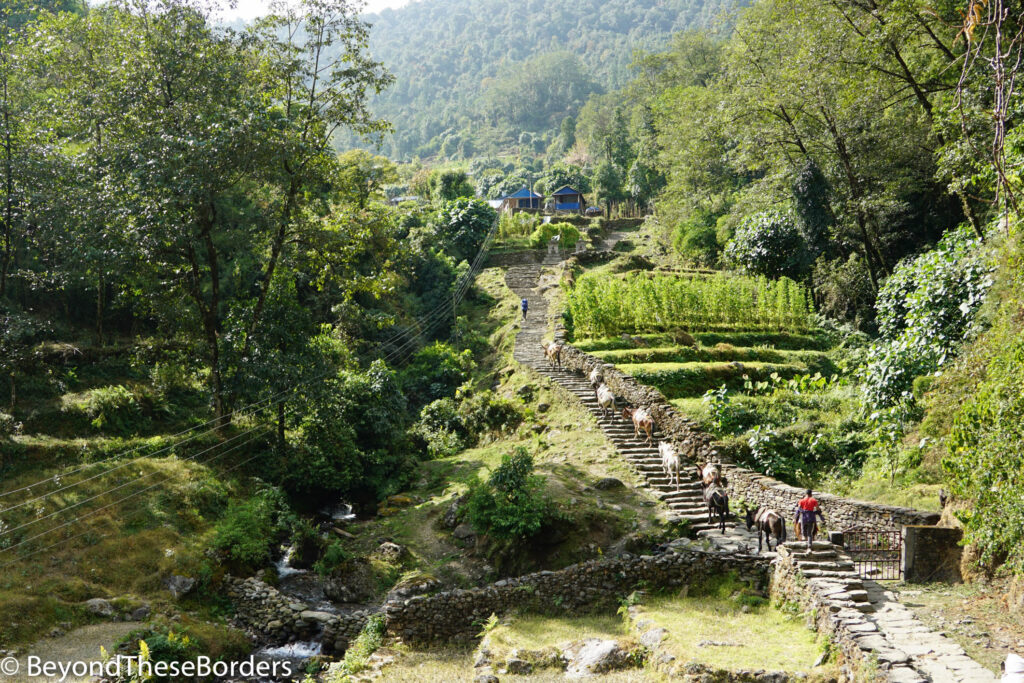
Once safely on the other side, the climb up to the village of Chomrong began. Stone steps led us up endless hills. Homes scattered across the lush green terraces welcomed us to the outskirts of the village.
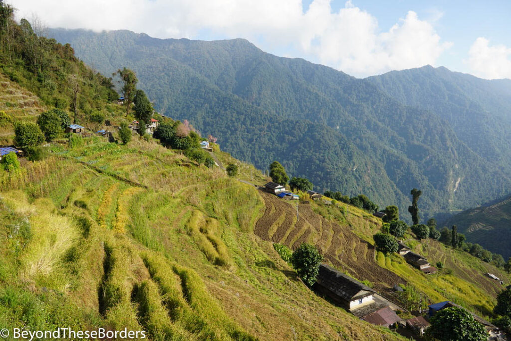
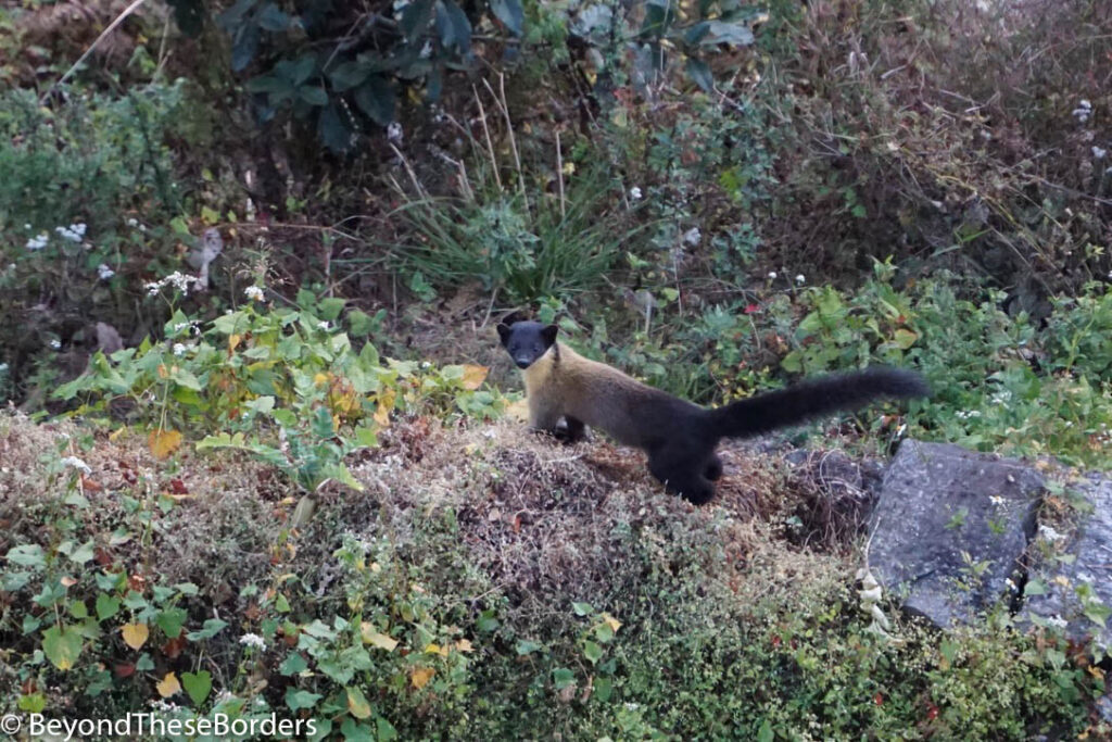
Our second lodge did not disappoint! We had a view high above the lush green river valley behind us and of the rolling green mountains in front. Behind these mountains, the clouds would roll in and out, teasing us with views of the Annapurnas beyond. Not only did it offer awesome landscape views, but we also spotted a bit of wildlife. Just outside our lodge a marten (a weasel-like mammal) posed for our cameras. Farther away, a group of monkeys swung between branches of distant trees.
Day 3: Chomrong to Bamboo (6 miles)
We woke to a clear view of the mountains ahead. After warming up with steamy coffee or tea and breakfast, we grabbed our sink-washed clothes drying on the lines around the lodge and packed up for another day on the trail.
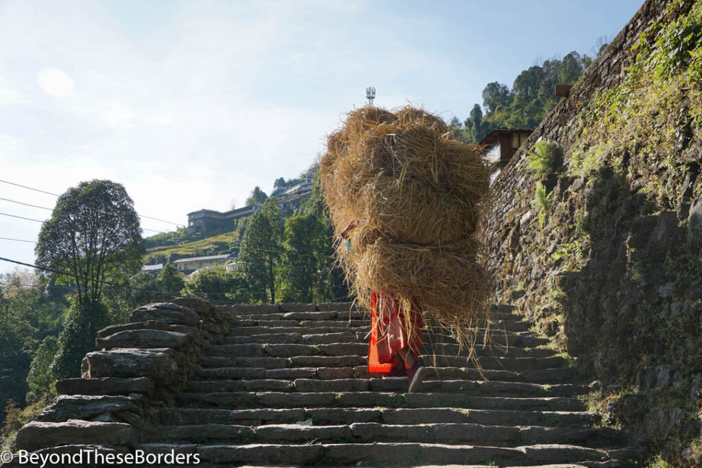
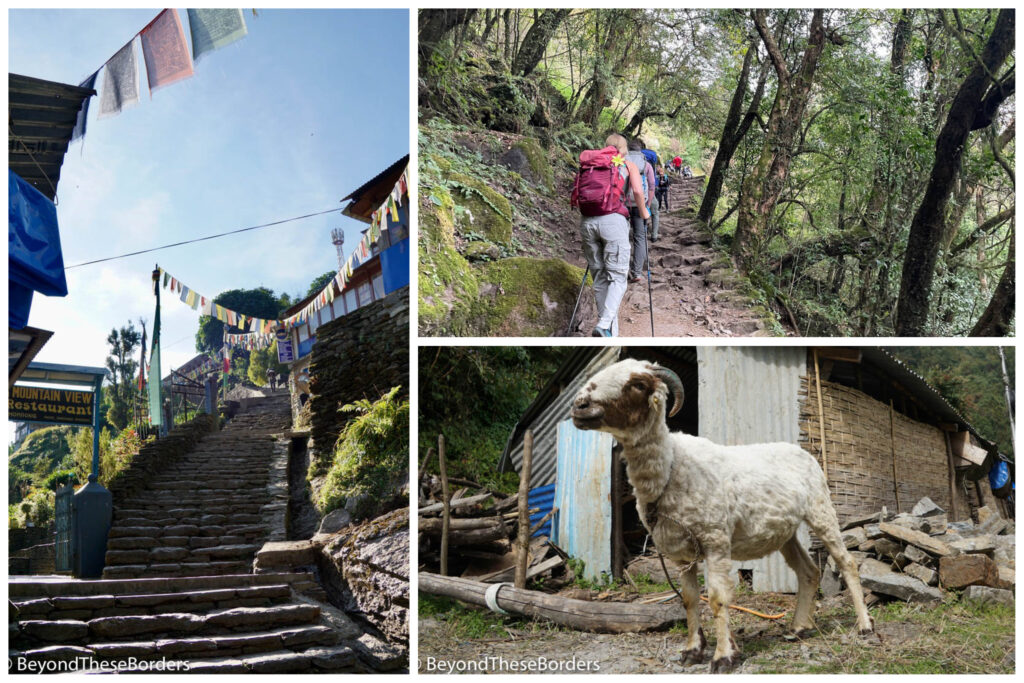
We passed through the rest of the village of Chomrong… stone steps up and down. Watching locals doing their daily commute on all these stairs is eye opening. Old men with walking sticks, men carrying heavy supplies in baskets on their backs balanced by straps on their foreheads, and ladies carrying so much hay that you can’t see their bodies.
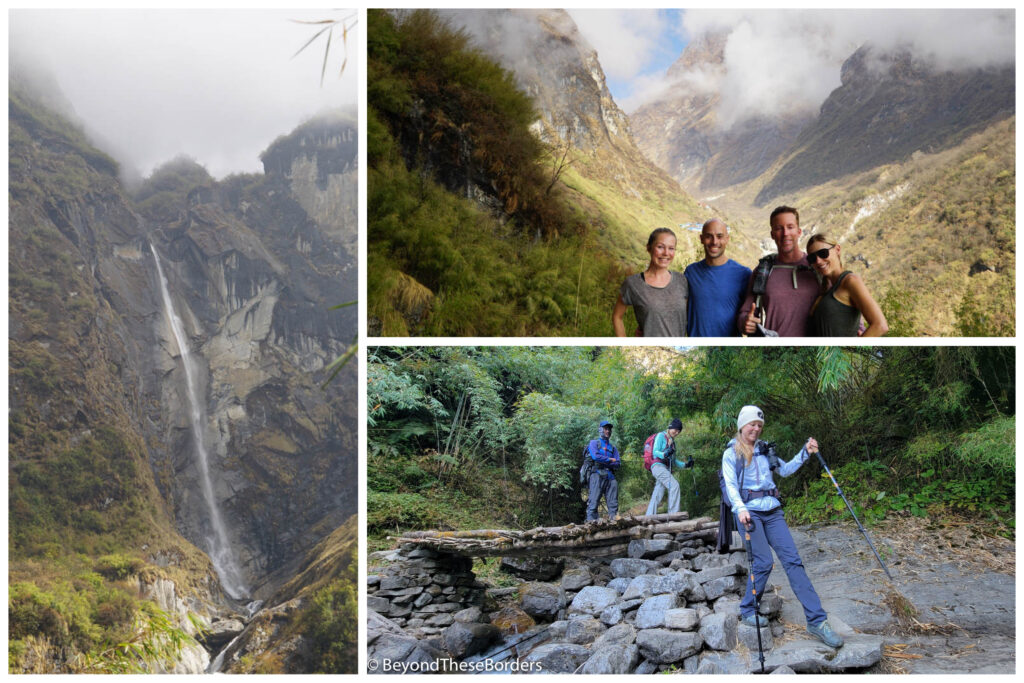
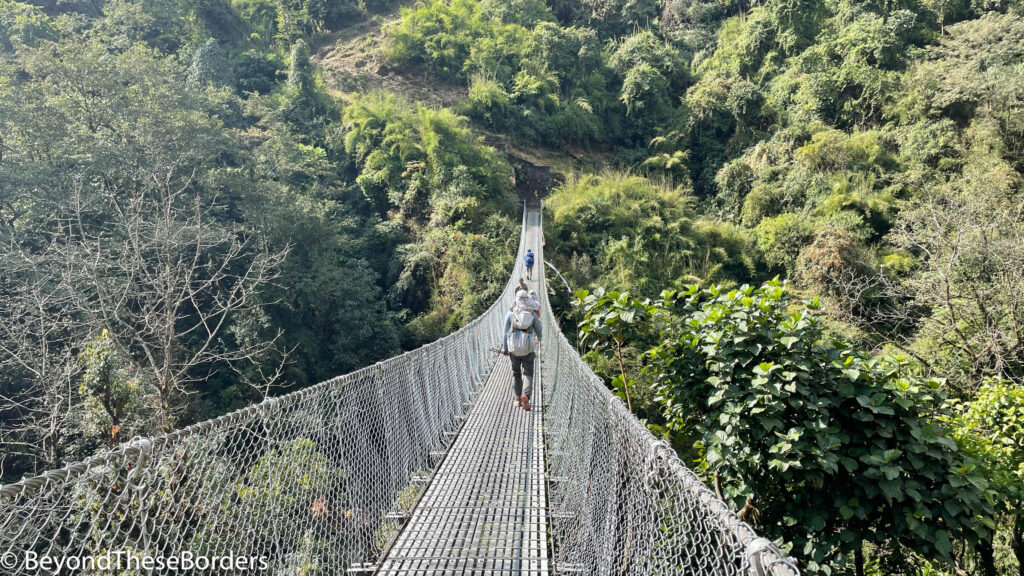
We were accompanied though town by another sable colored dog. They all looked exactly the same, as if the same dog was with us most of our trek. A steel suspension bridge led us out of the village. Although higher than our first bridge, this one seemed much more trustworthy.
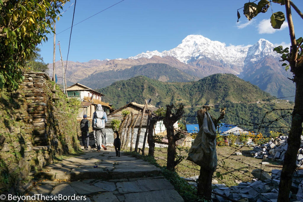
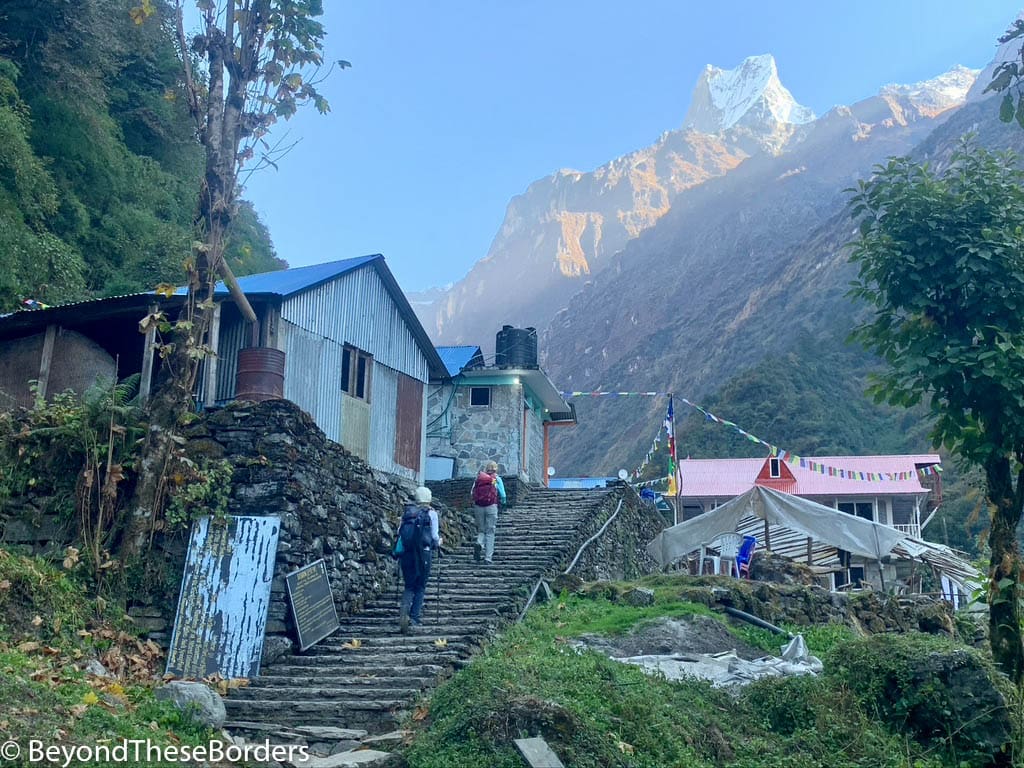
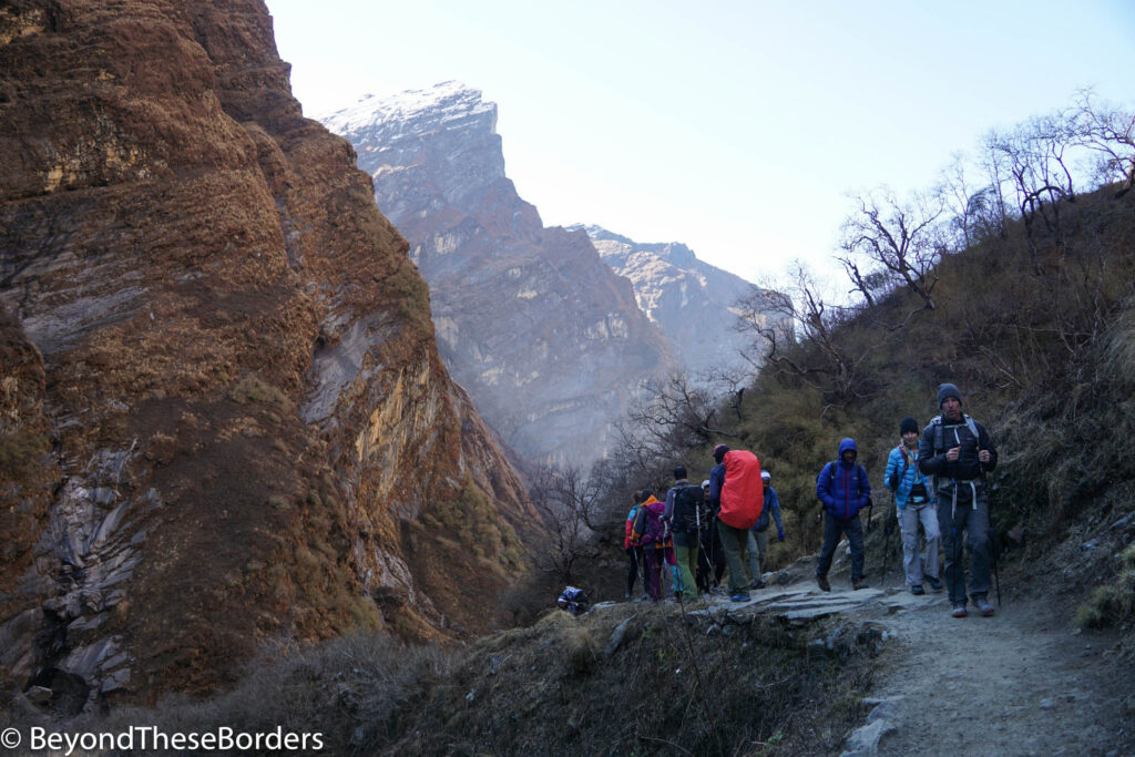
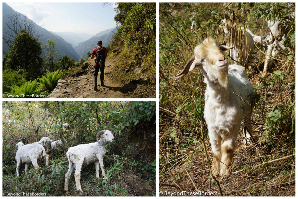
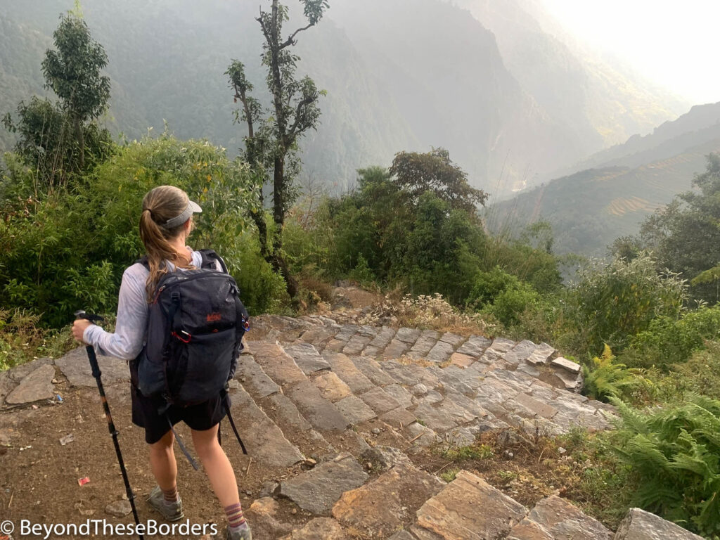
Although we were hiking from 7,100 ft of elevation to Bamboo at just 7,700 ft, it was anything but flat. After hiking down out of Chomrong and crossing the bridge, we started heading back up another hill for the next village. The views behind us were sensational. The green valley spread out below us as we made our way along the stone and dirt trail. In front of us, we could just see the top of Fishtail poking out from behind the hills encouraging us along.
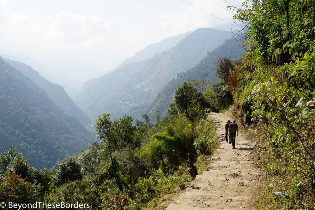
Trees began to obscure our view, rising up from each side of the path. Shaded from the sun, we put another layer of clothes on and enjoyed the forest. That night we stayed in the town of Bamboo with the Annapurnas hidden away from view.
Day 4: Bamboo to Deurali (6.25 miles)
Leaving Bamboo, we hiked through more forest and even spotted a few monkeys along the trail. More and more steps awaited us and we relished the rare areas that were flat. We loved crossing over cascading streams on little wooden bridges along the way.
We started seeing strings of prayer flags hanging between trees over the wet rock trail. Then the trees opened up to reveal a small temple with a wide gentle waterfall behind it. It was the perfect place for a break.
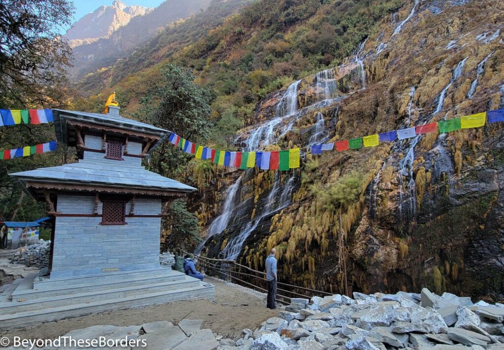
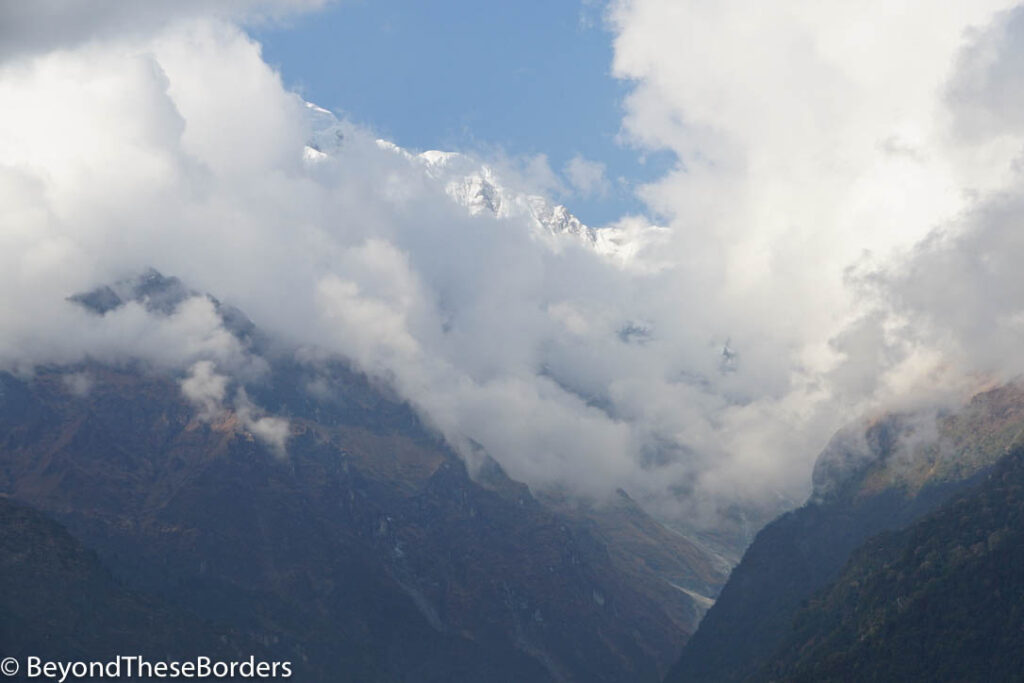
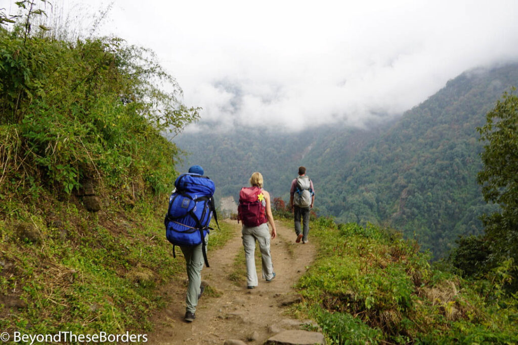
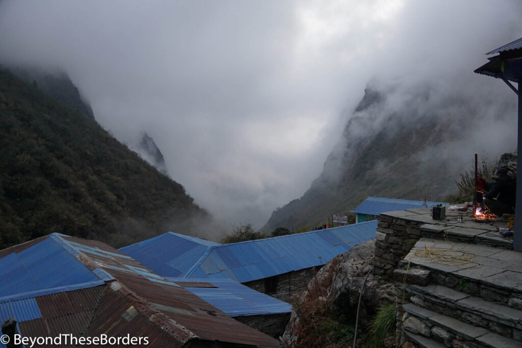
The Annapurna Mountains were hidden from us all day though Fishtail was visible for a while around the village of Dovan. Shortly after the temple, the trail opened up and we could see other small waterfalls dropping from the other side of the valley walls. We crossed large boulders and over more rushing streams. Finally we reached our lodge in Deurali as the fog encapsulated the village for our last night before basecamp.
Day 5: Deurali to Annapurna Base Camp (4.7 miles and 3000 ft elevation gain)
This was the day we would reach Annapurna Base Camp! The day started off well with an early morning sighting of a pica next to our lodge. Despite how they look, they are not rodents. They are lagomorphs (same family as rabbits).
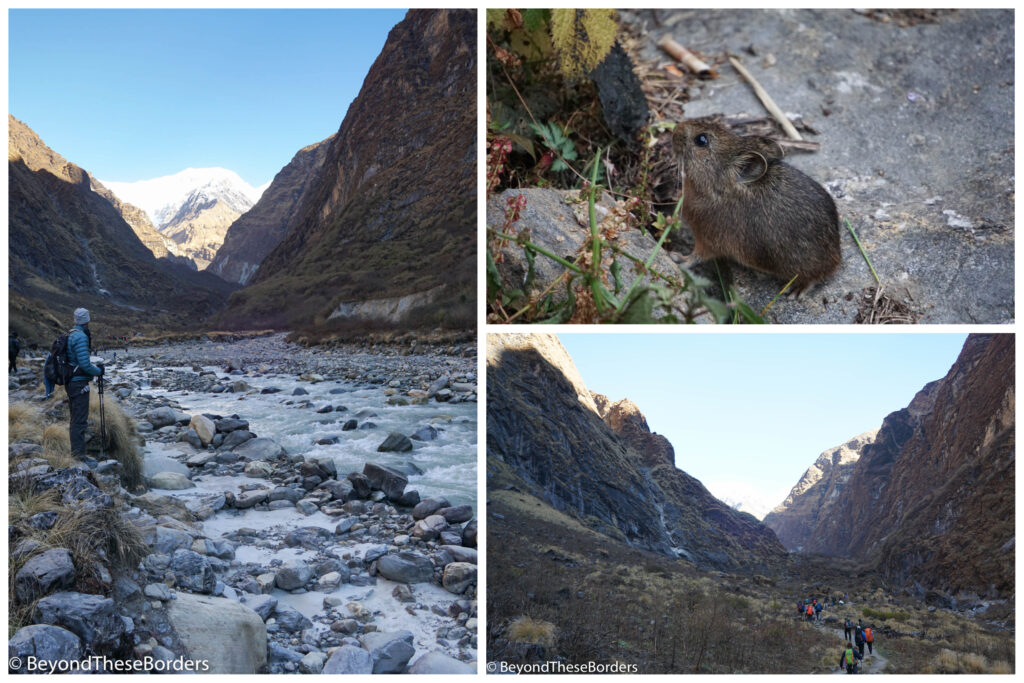
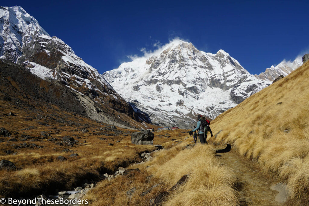
We hiked into the brisk morning, bundled up in our hats and puffy jackets. The trail followed a nearby rocky river, leading us through the valley between small mountains.
Then we started gaining elevation again and soon could see the blue lodges of Machhapuchhare Base Camp. To the east, Machhapuchhare (Fishtail) towered in the sky and to the west, the Annapurnas rose over the hills. We rested here for our lunch break before we tackled the last section.
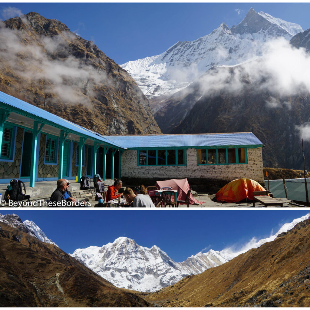
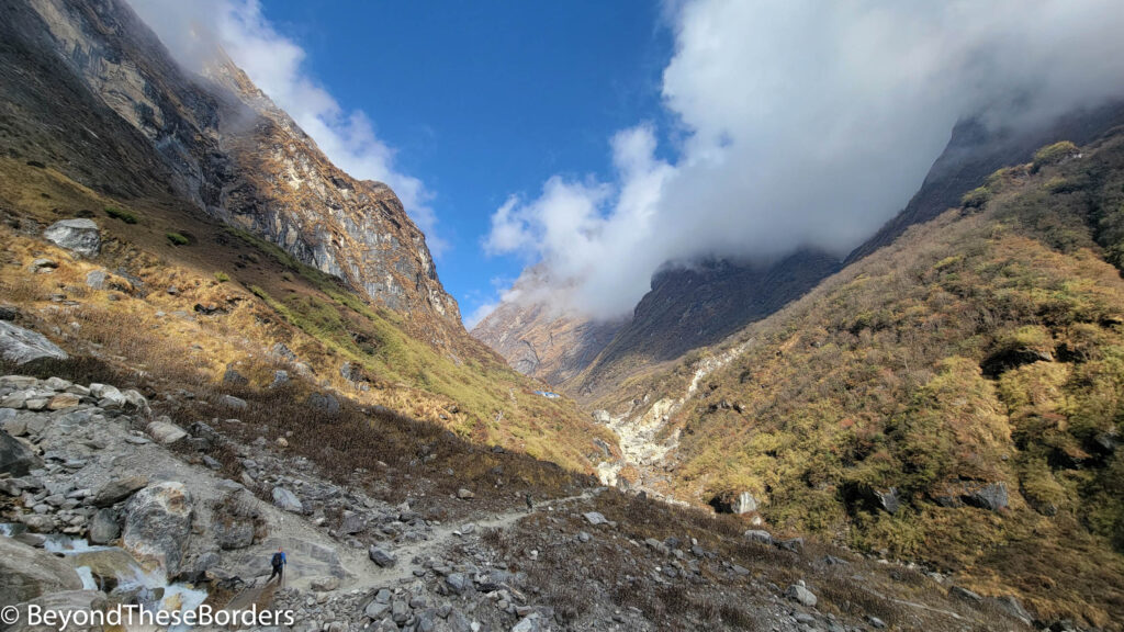
As we started the final leg of our journey to Annapurna Base Camp, a thick eerie fog rolled in. For much of the hike up, we couldn’t see more than 50 feet in front of us, much less the giant white peaks we were hiking towards. The trail led us up a gentle incline deeper into the fog, giant rocks scattered among the straw-colored long grass around us. A tiny stream made its way downhill, flowing under a frozen top crust.
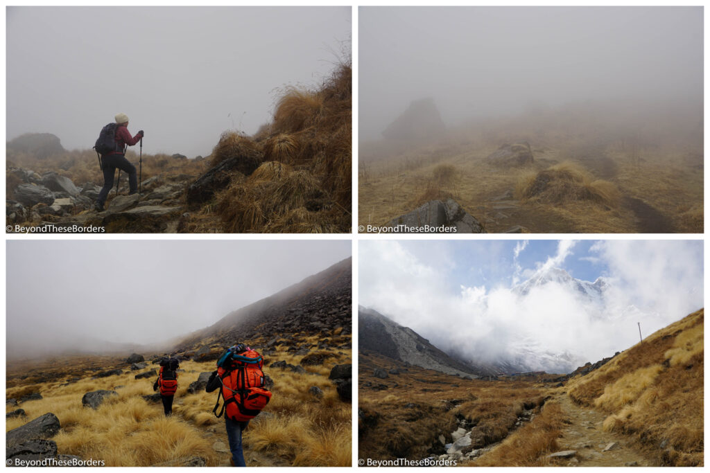
As we walked up the final hill, the clouds began to lift and open up a bit. We could spot the lodges and parts of the towering mountains behind. We had finally made it to Annapurna Base Camp at 13,549 feet of elevation!
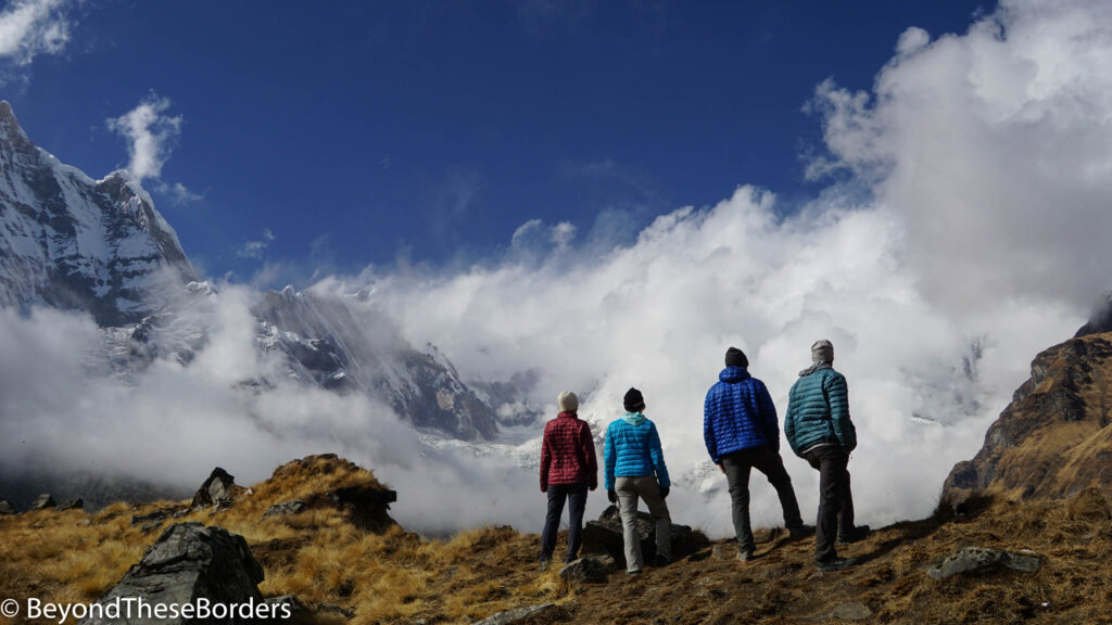
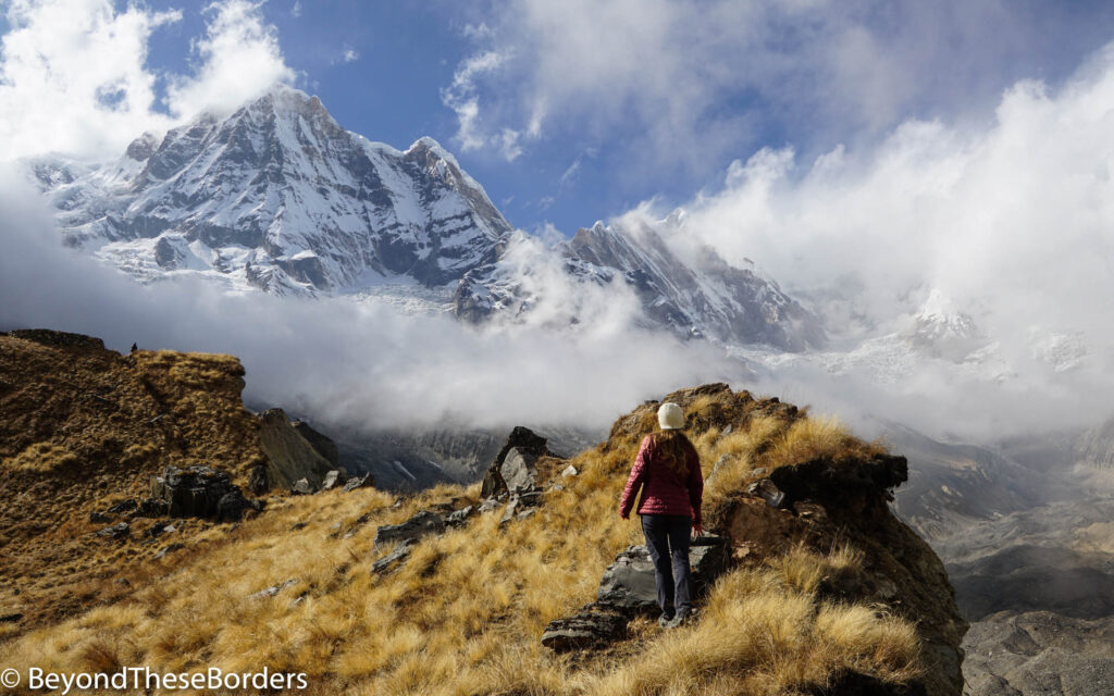
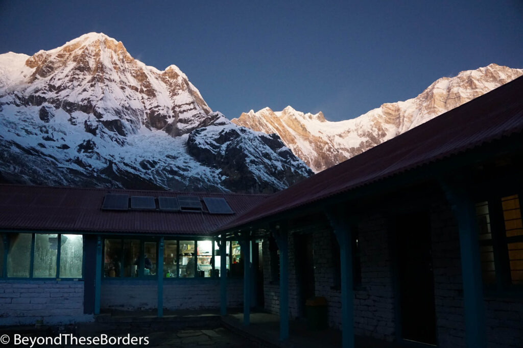
We dropped off our bags and went out to explore the area around the lodge. It felt magical watching the clouds glide in and out around the snow-covered mountains. West of the lodges rest Annapurna South, Annapurna I, and Annapurna III. Looking back east where we had hiked from, there is a great view of Machhapuchhare (Fishtale) as well.

Day 6: Annapurna Base Camp to Bamboo (10.8 miles and 6000 ft elevation decrease)
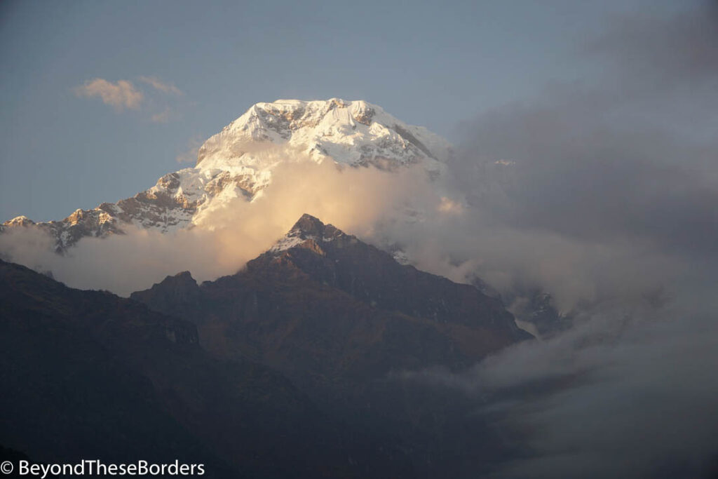
We started the day by watching the rising sun light up the tops of the Annapurna range along with every other bundled up trekker. All the clouds were gone now and we could see it all!
Unfortunately we had a long day ahead of us, and we needed to start the hike back down a couple hours later. The sky remained clear, letting us enjoy all the great views between Annapurna Base Camp and Machhapuchhare base camp that we had missed on the way up.

We passed Machhpuchhare Base Camp and headed back between the small mountains and by the river. We hiked past the village of Deurali, through some trees, and passed the small temple and waterfall. We were decreasing altitude the whole way. By the time we finally reached Bamboo, there was barely enough sunlight left to see the trail under our feet. We had hiked over 10 miles and over 6000 feet elevation decrease and my knees were very sore. As we ate dinner, lots of hikers lighting their way with headlamps were still making their way down.
Day 7: Bamboo to Jhinu Danda (5.9 miles, 1500 ft elevation gain, and 3200 ft elevation decrease)
After a much needed night of recovery, we were back to the stone steps. These led us up and down through the woods, out into the warm sunlight, and down past a bunch of goats and sheep grazing in the shrubs near town. A shepherd eventually pushed them along their way, in the opposite direction of ours. After walking over a long suspension bridge, we started following a pack of mules up the seemingly endless steps up to the village of Chomrong.
As soon as we made it to the top, we immediately started heading back down steep stairs towards the village of Jhinu Danda. My knees started to hurt again. And then it began to rain. We hid under a rock overhang hoping it would pass, but it just rained harder. We were close to the village and therefore decided to just head out into the rain. A couple minutes later, it also began to hail. 😂 Luckily just tiny balls of hail, about the size of peanuts, bombarded us. We made it to camp, dried off, and enjoyed a drink in the lodge to celebrate how close we were to done.
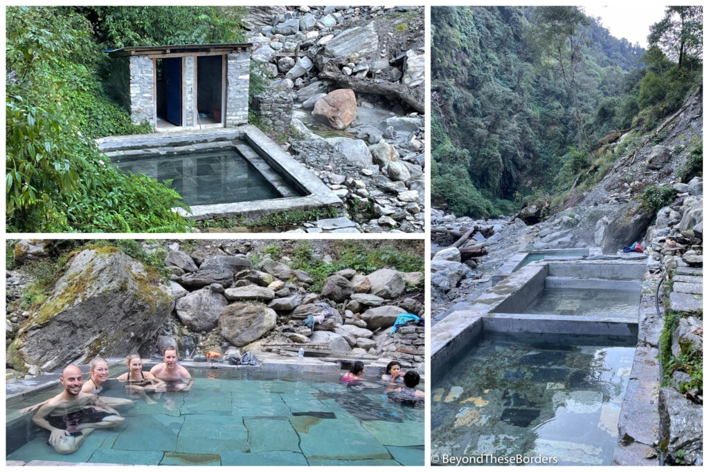
Day 8: Hot springs, Jhinu Danda to Siwa/Ghandruk Phedi (2.4 miles)- then drive to Pokhara
After a nice breakfast with a fabulous green mountain view from our table, we set off early (around 7 am) for the nearby hot springs. About 30 minutes of hiking and a cheap entrance fee (about $1 USD), we found the hot springs. They were simple concrete pools of fabulously warm water down near the river. Only two other people were there, so it seemed visiting in the early morning was a good choice, rather than in the late afternoon after arriving the day prior (the original plan). We thoroughly enjoyed relaxing in the hot water with the sound of the nearby river. Feeling clean and relaxed, we changed into dry hiking clothes in the provided changing rooms, and hiked 40 minutes back up to check out of the lodge.
A quick hike from the lodge brought us to the highest and longest suspension bridge of the trip. The bridge connected to the green terraces and tree covered hill on the other side of a river gorge. It took about 4 minutes to walk across as it swayed just slightly with each step.
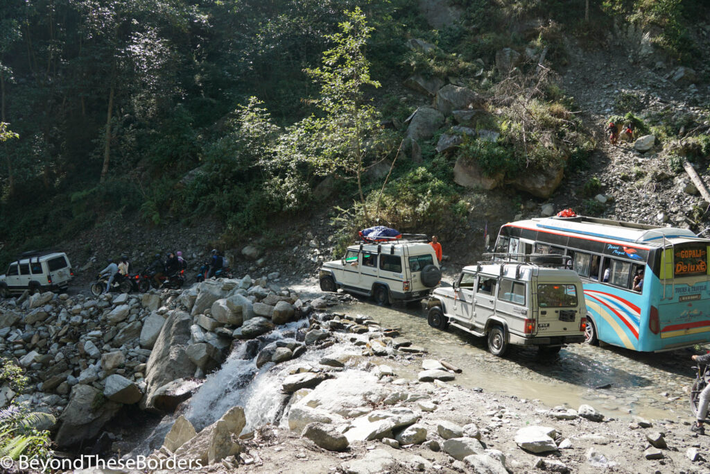
Once on the other side, we just had to hike up to the road, and claim one of the jeeps waiting to take trekkers back to Pokhara. Driving away, we were amazed at the way vehicles maneuvered around each other on the narrow winding roads. We found ourselves in a traffic jam along the way and had the good fortune of being stopped in the middle of a small waterfall along the road. After 20-30 minutes, the drivers had worked together to get a stalled vehicle out of the road and we were back on our way.
Once back in Pokhara, we enjoyed a dinner with our guide and Porters, thanking them for all their help during our adventure. The next few days we relaxed and enjoyed the beautiful lakeside town. My previous post, Nepal: Chaotic Kathmandu and Peaceful Pokhara describes what we saw and did in Pokhara as well as Kathmandu.
The Details:
We booked our guided hike with Discovery World Trekking. Check out their website here: Discovery World Trekking. They advertised a competitive price and had many positive reviews online. We chose the short 7 day trek but added one extra day on the way up to base camp. They were very accommodating with our desired changes.
If I were to plan this trip again I would also add one extra day on the hike back down from Annapurna Base Camp to Bamboo. In my opinion, it was by far the hardest day. 6000 ft of elevation decrease in a day makes for some very sore knees and hiking in the dark, trying not to trip on rocks and tree roots is rough.
Loved reading this and seeing your amazing pictures! What an incredible adventure!!
What an amazing experience! All those steps and hiking in the fog and dark would make it a difficult trip for many. The views were gorgeous!
This was a fantastic read and I am glad I was able to read it really an exciting adventure for you and even for me to experience it thru you and your pictures thanks ever so much for sharing it
Exciting adventure! Loved reading about each day of your hike and the pictures weee a nice added touch! Nicely written. Loved it.