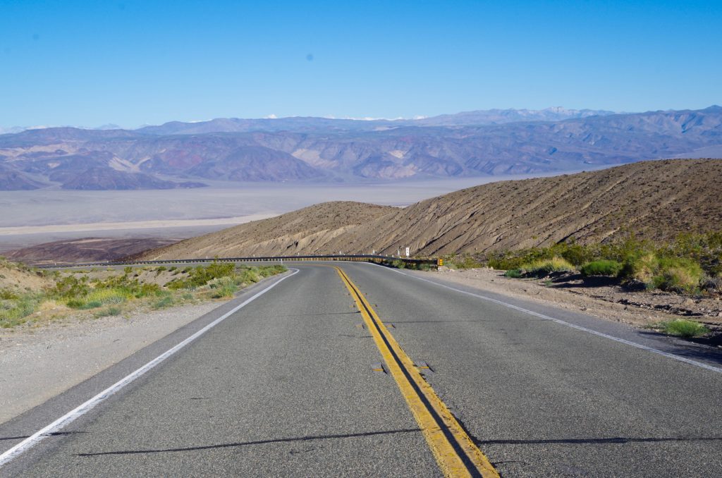
The night before: Spend the night inside or close to the national park.
We stayed at Panamint Springs Campground, located on the western edge of Death Valley National Park. They have a bar serving good food and a large variety of craft beer. Camping is cheap too at only $10 for a site.
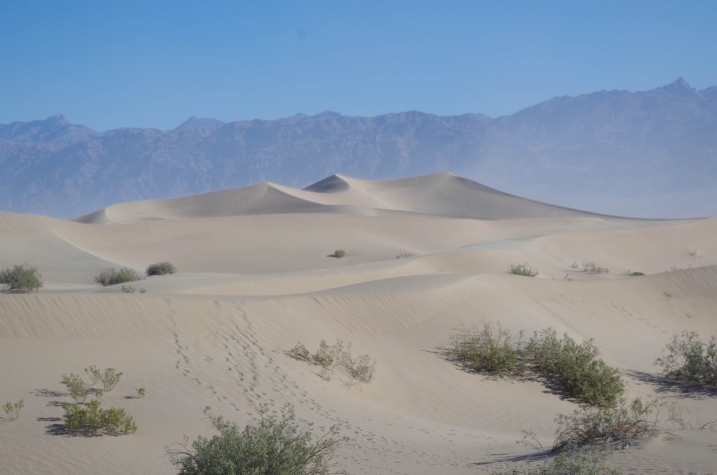
Stop 1: Climb Mesquite Flat Sand Dunes.
These are the most accessible sand dunes in Death Valley and sit about a half hour drive from Panamint Springs. They are located near other top attractions in the valley and parking is just off the sand. It is recommended to visit them at sunrise or sunset to see dramatic shadows across the dunes. Sunrise was at about 6 am. We got up early, but not early enough to get the prime effect.
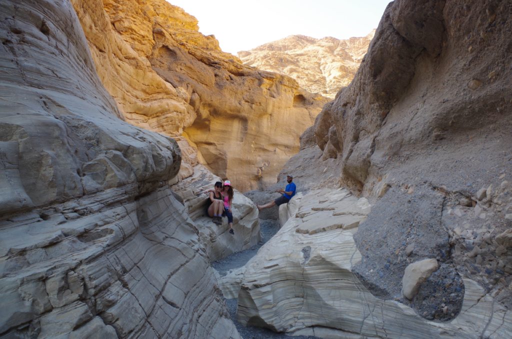
Stop 2: Hike Mosaic Canyon.
You only need to walk a short distance into Mosaic Canyon to enjoy it. About a ¼ mile in, you enter a narrow, winding slot carved through the rock. The next ¼ mile or so is fantastic! Savour the escape from the heat within the cool shade of the canyon.
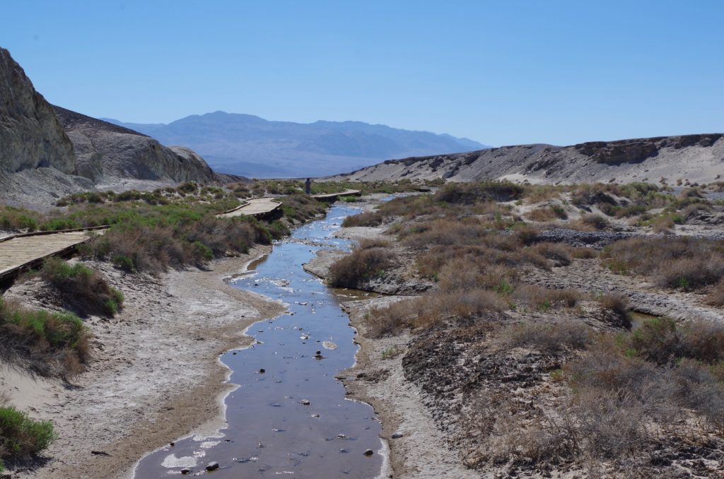
Stop 3: Salt Creek and it’s Pupfish… Yes there is water in Death Valley.
These small desert fish are tough guys. They can survive in water that is 4x as saline as the ocean and temperatures near freezing to over 100° F! The wood walkway will bring you close enough to see the fish.
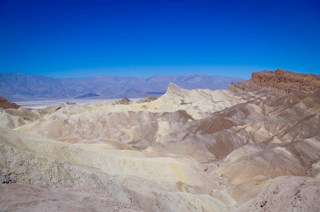
Stop 4: Walk up Zabrinske Point to see the Badlands of Death Valley.
This stop provides a different scene of Death Valley, overlooking colorful ravines. Great photo opportunities here. If you are spending more time in Death Valley, there is a hike that connects Zabrinske Point to Golden Canyon that sounds great.
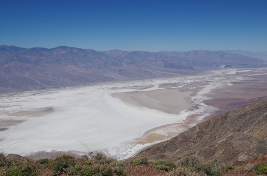
Stop 5: Gawk over Death Valley far below you at Dante’s View.
This is a perfect stop to gaze at the expansive valley. Have a sweatshirt ready, it was only 58 degrees up here 5,500 feet above sea level.
Lunch Break:
Stop for lunch at Furnace Creek Village before heading down Badwater Road. The village has a buffet and a bar with food. I wan’t overly impressed with the food here… But if you want to buy lunch rather than pack your own, it is conveniently located and has air conditioning.
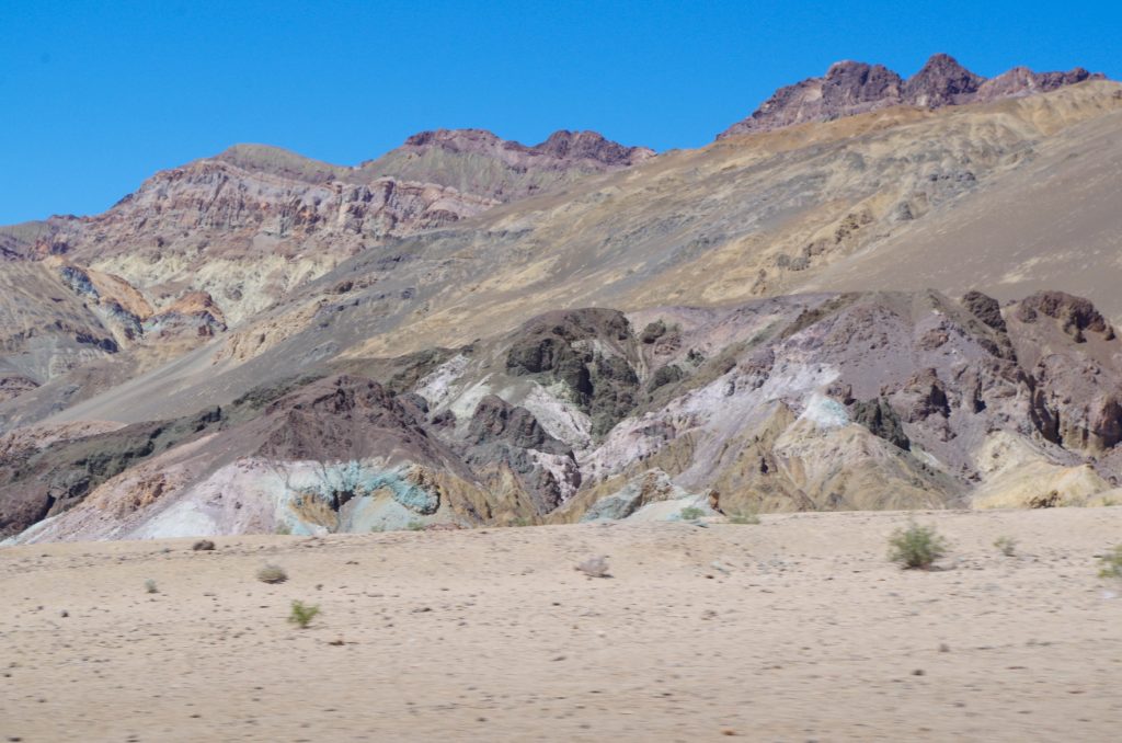
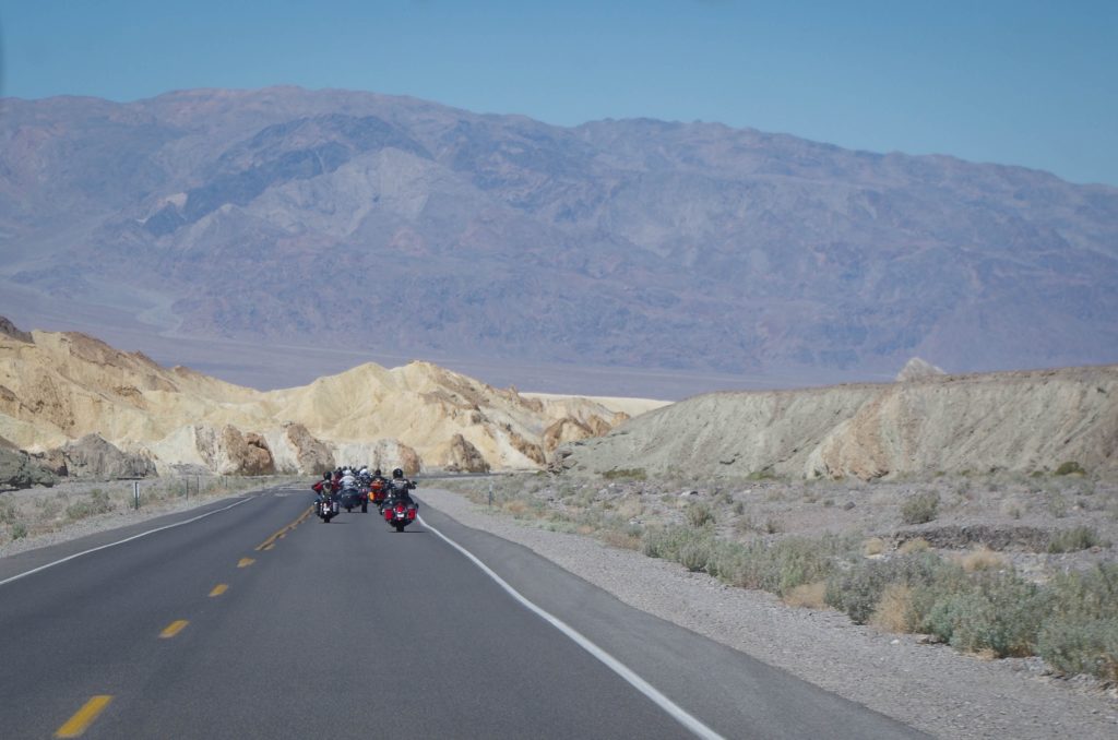
Stop 6: Drive along Artist’s Drive to see Artist’s Palette.
Skip the first parking area you see. This spot has a bit of a hike to a less than spectacular view in my opinion. A short drive further along the road brings you to a much better view without any hike. The mountains are splattered with a variety of colors due to oxidation of metals within the rock.
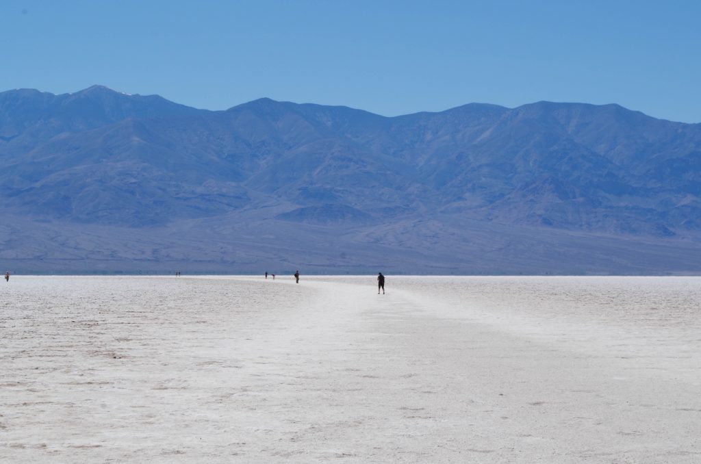
Stop 7: Marvel at the Devil’s Golf Course.
This area was once under a large lake. When the lake evaporated, it left behind the salt and minerals that make up the Devil’s Golf Course and Badwater Basin. Being above sea level, this area doesn’t flood (which would smooth out the salt). Instead it is sculpted into formations by the evaporation of underlying salty water and erosion by wind and rain.
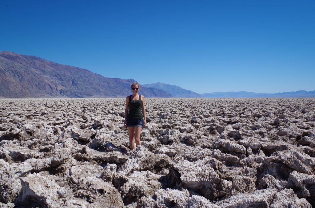
Stop 8: Walk out onto the salt flat of Badwater Basin.
You will be standing at the lowest elevation in North America (282 feet below sea level). Like the Devil’s Golf course, this flat is leftover from the same lake. Here the salt lays flat. Due to its lower elevation, rainstorms flood the area and smooth out the salt before the water evaporates. On our visit, it was a balmy 93 degrees here…. Quite the contrast to the chilly air directly above on Dante’s View.
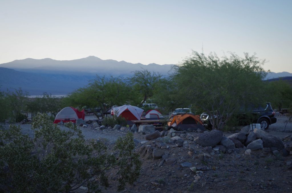
Night 2: Get off the beaten path at Warm Spring’s Canyon Campground.
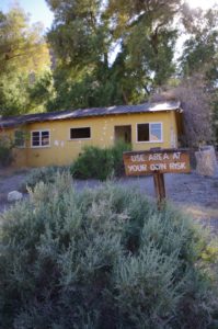 We drove further south along Badwater Road to spent the night at Warm Spring’s Canyon Campground. Here you find a couple abandoned buildings, which have fallen into despair. Add your names into the log notebooks and discover what others wrote about their stays here over the years. We set up our tents in front of the main building, near the fire pit. Shortly after nightfall, bats fly out just over your head from the hills behind you for their night hunt. Don’t miss the fantastic view of stars spread out above you. During daylight hours, you can follow the overgrown trail up to the small warm spring coming out of the rock formation beyond the house.
For some history of the camp, check out this post on Warm Springs Campground. Do not expect water in the swimming pool, as it has been permanently drained for safety reasons.
Directions to Warm Springs Campground: Drive South on Badwater Basin Road, turn west (right) onto West Side Road and west (left) onto Warm Spring Road. After passing an old mine on your left, watch for the yellow buildings of camp. The drive is about 30-40 minutes on rough sand, dirt, and gravel roads.
If you have a bit more time:
Sites I definitely want to check out next time:
1. Racetrack Playa – a dry lake where the rocks mysteriously move across its surface, leaving a trail behind them. (About a 3 hour drive from Furnace Creek)
2. Ubehebe Crater – Large volcanic crater created by steam and gas explosions. (Along the drive to Racetrack Playa)
We reached our campground the second night around 4 pm. So you definitely have time to fit a few more sights in if you want to make a full day of sightseeing.
For more information, check out these sights:
National Park Service site for Death Valley
Death Valley National Park’s Facebook Page (They have videos, theres a tab along the left side of their home page)
Leave a Reply